This section of the directory addresses that part of ‘Cultural Heritage’ in the coastal zone, which can be further subdivided into Archaeology and Built Heritage. For the purposes of the directory this section will be organised under the following headings:
 |
Charles Fort in
Kinsale, County Cork |
ARCHAEOLOGICAL HERITAGE
Coastal Archaeology
Intertidal Archaeology
Underwater Archaeology
BUILT HERITAGE
Coastal Structures
Ports & Harbours
Industrial Heritage
LANDSCAPES & SEASCAPES
ORGANISATIONS
FOLKLORE
AND FOLKLIFE
‘Archaeological heritage’ is that part of the material heritage in respect of which archaeological methods provide primary information. It comprises all vestiges of human existence and consists of places relating to all manifestations of human activity, abandoned structures, and remains of all kinds (including subterranean and underwater sites), together with all the portable cultural material associated with them.
‘Built heritage’ refers to the architectural remains of previous settlement and human activity. These remains may be either abandoned or still in use and consist of constructions of every type of human activity, from domestic, and industrial, to ecclesiastical. Built Heritage includes architectural features and industrial heritage associated with the coastal zone, such as lighthouses, quays and piers and it also refers to historic gardens and parks.
 |
Coastal
Monument, Bunowen More, County Galway |
Although the National Monuments Act is the primary instrument through which Archaeological and Built Heritage is protected, there are a number of additional conventions, directives and national statutes, which provide further cover. All the protective instruments relating to the protection of Archaeological and Built Heritage are described under the headings International or National.
In addition to this, site types can be subdivided chronologically based on their recognised cultural associations. Chronological subdivisions are described under the headings Mesolithic (7500BC-3500BC), Neolithic (3500-1800BC), Bronze Age (1800-500BC), Iron Age (500BC-500AD), Early Christian/Medieval (500-1200AD), Later Medieval (1200-1600AD). Due to Ireland's topography and its status as an island nation, human activity has always been closely associated with the coastal zone. Access to overseas commerce by way of ports determined the location of the country’s major cities, while exploitation of river mouths gave these coastal ports access to the country’s interior, e.g. Drogheda on the Boyne, Dublin on the Liffey, Waterford on the Suir, Cork on the Lee, Limerick on the Shannon, Galway on the Corrib etc. In addition the interior of the Ireland proved in many places inhospitable to habitation either as a result of the presence of bogland or dense forestry. Over time Ireland’s natural forestry has been cleared. However, the coastland and coastal plains remain the preferred area for human habitation. As a result the coastlands and intertidal areas of Ireland are rich in archaeological and built heritage with evidence remaining of all the people that have lived on and passed by these shores, from the earliest settlers, through to Roman traders, raiding Vikings, and medieval travellers.
Consequently, while many of the sites and monuments recorded in Ireland may be exclusively associated with the coastal zone, e.g. promontory forts, middens, lighthouses, coastguard stations, etc., there are few monuments and sites found nationwide that may be excluded from it.
 |
Reconstruction of
fishtraps |
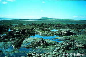
Coastal Archaeology in Ireland is a broad ranging topic in that there are numerous archaeological ‘features’ that can be directly associated with the coastal zone. Some of these features have obvious links with coastal protection, e.g. promontory forts, while other less well-known features are associated with the practices of coastal communities, e.g. fish traps and kelp grids. There is no definitive list of archaeological features associated with the coastal and intertidal zone, as it is possible that all archaeological features so far recovered in Ireland could feasibly be found in the coastal zone. However, the following is a list of archaeological features with specific association with the coastal zone. The list is by no means exhaustive and may be updated in future editions of the directory. Examples of types of archaeology and locations of recorded features can be viewed in the section of the directory that addresses coastline characteristics and associated heritage.
- Seasonal prehistoric hunter/gatherer settlements
- Shell middens
- Coastal portal tombs
- Coastal promontory forts
- Coastal settlements / clachauns
- Earthworks
- Souterrains
- Viking Longphorts
- Early ecclesiastical settlements
- Barrows
- Cists
- Henges
- Signal towers
- Ports, and quays
- 18th/19th century coastal defenses
- Lighthouses
- Breakwaters
- Graveyards
- Fish traps
- Kelp grids
- Kelp kilns
For a general description of common Irish field monuments, click here.
Archaeological features specific to the intertidal area relate to historical practices such as fishing, e.g. fish traps. Fish traps have been recorded at several locations around Ireland and were constructed either from stone or wood. Fish traps were the most common feature recorded in the upper reaches of the Shannon Estuary and the Fergus Estuary, Co. Clare by Dr. Aidan O’Sullivan of the Discovery Project (O’Sullivan, 2001). The Shannon Estuary Survey was the first attempt to investigate coastal wetland and foreshore archaeology in the Republic of Ireland. Archaeological features associated with the intertidal zone include:
- Fishing huts
- Fish traps
- Woven baskets
- Kelp grids
- Wooden jetties
- Stone jetties
- Post alignments
- Post and wattle panels
- Post and wattle fences
- Submerged forest and peat
- Intertidal walls
- Stone slipways
- Carved wood
- Wooden planks
- Worked wood
- Animal bone
- Shipwrecks
- Historic boats
 |
Medieval Fishtrap,
Bunratty, County Clare |
In 795 AD, the first Viking raid is recorded in the Annals of Ulster. It tells of attacks carried out by the Norsemen on the monasteries of Inishmurray, Inishbofin, and Rechru; and so contact began between the Irish and Viking culture which was to last for over 200 years. This contact would change Irish society to a degree still evident today.
The nature and extent of this contact is highly controversial and ranges between two extremes; one which sees the Vikings as invaders and destroyers, who plunged a peaceful country into 200 years of turmoil and inter-tribal war. The other sees the Vikings as the bringers of urbanisation, introducing new ways of living to a people isolated on the fringes of Western Europe and removed from cultural, commercial and political innovations which were sweeping through other countries throughout Europe. The truth probably lies somewhere between these two opposing views.
Initial sporadic raiding gradually gave way to more prolonged onslaughts, and in 840/1 AD the first encampment for overnight wintering was established by the Vikings on the shores of Lough Neagh. Over the years, this was followed by similar encampments throughout the
 |
Cork Harbour |
Viking settlement was largely confined to the coasts, and usually in the immediate hinterland of their towns. Through these settlements, interaction with the native Irish became an everyday occurrence and gradually both peoples would begin to influence various aspects of the others culture. This influence is evident in metal work and the illuminated manuscripts produced at this time. The distinctive animal interlace, or Ringerike, style of Viking decoration was adapted by the Irish, but changed so it became distinctly Irish. They brought improvements in metallurgy, and smithing. Aspects of their language are still evident in place names, e.g. Dalkey, Leixlip, Skerries, and in family names still found in areas where they settled, e.g. Smith, Gowan and their derivatives. As well as introducing the concept of towns built around commerce and trading, the Vikings also introduced the first coinage used in Ireland, and connected the port towns they had established with wide trading networks that stretched as far as Constantinople. Indeed Dublin would grow to dominate trade on the Irish Sea and would continue to do so well into the 15th century. They forged permanent trade and later ecclesiastical links with Viking settlements in Britain, which may indeed have paved the way for the most profound Viking legacy of them all, the Norman Invasion.
Ireland’s Armada Legacy
 |
Sailing Boat Mast |
The steady decline in relations between England and Spain after 1558
lead to hostilities that broke out in 1585 and dominated the last years
of lives of Philip II and Elizabeth I. Yet it was not a conflict that
either of them sought and war was never formally declared. The drift into
war meant that a number of fluctuating issues and pressures became involved
and assigning precise causes is not easy. But, if there is one, it is
undoubtedly what became known in the Catholic world as the Empresa
de Inglaterra (the Enterprise of England), the overthrow of the new
Protestant regime.
In 1588, Philip dispatched about 130 ships making up the Spanish Armada
into English waters where it met with the English on two occasions in
Iberian waters in June and July. The English fleet of sixty-six ships
on return to port was caught by surprise re-supplying in Plymouth when
the Armada appeared. Although they were able to escape from Plymouth successfully,
they were faced with a stern chase up the Channel. Much ammunition was
expended, but the Spanish formation held together well, and only two ships
were lost, both by accidents. The Spanish admiral, the duke of Medina
Sidonia, then took the unexpected decision to anchor off Calais on 6 August.
This enabled the English to disperse his fleet by a fireship attack and
strong winds blew it into the North Sea. Four Spanish ships were lost
at this point, but the great majority escaped northwards. However, there
was now no alternative to the risky voyage home round Scotland and Ireland.
In the course of this a further thirty-four or five ships, mostly weaker-built
transports, foundered or ran aground.
While the exact location of several of the Armada wrecks is unknown, there
are 14 recognised wrecks sites in Irish waters; three off the coast of
Co. Antrim, two of the Coast of Co. Donegal, three off the coast of Sligo,
three off the coast of Co. Mayo, one near Spanish Point in Co. Clare and
two off the Dingle Peninsula in Co. Kerry. Including those that were wrecked
off the Ulster coast, the estimated number comes to between twenty and
twenty-four. This of course resulted in the loss of many ships laden with
valuable stores and arms and the landing of armed and trained Spaniards
on the mainland. In addition to contemporary accounts there is now the
legacy of the wrecks themselves.
More information on Ireland’s Armada Legacy can be found in Laurence
Flanagan’s book of the same title and by clicking here.
18th Century Maritime Trade
Ships and shipping have always been important to Ireland. The significance
of the locations such as Dublin, Waterford, Cork and Galway as ports has
meant that they have relied on the sea for trade, defence and as a means
of earning a living. Renewed confidence in Irish shipping and advances
in ship technology meant that Irish Merchants were more willing to explore
the possibility of establishing trade contacts with newly emerging locations
and strengthen existing ones. This new confidence saw the emergence of
five distinct trade forms. The first of these was coastal trade, a large
portion of this trade involved supply and trade of raw materials and basic
essentials between small local ports and the larger regional ports.
The second form of expanding trade was the Anglo-Irish trade. This trade
was concentrated mainly between Britain and the east coast ports. Previous
centuries had seen the development of strong trade links between Irish
ports such as Waterford, Wicklow, Dublin, Drogheda, Dundalk and Belfast
ports with British ports such as Bristol, Liverpool and London. In the
18th century these trade links were greatly strengthened and the volume
of trade increased.
The third form of trade was the Irish – European trade. By the 18th
century trade links had been well established between Ireland and Continental
Europe. Excavated material recovered from towns such as Cork, Waterford
and Galway indicate a very strong trade of assorted cargoes between Ireland
and Continental Europe. The successful arrival of a French Armada expedition
in Bantry Bay in 1796 indicates a strong French knowledge of the geography
of the Irish Coast. A similar assertion can be made for Spanish and Portuguese
trade.
The fourth form of trade was the newly emerging trans-atlantic trade.
The emergence of the British colonies in North America saw the establishment
of strong trade links. Prior to this Irish trade with the area had been
confined mainly to fishing related activities. Ireland was located along
the western route of transoceanic trade. Outward-bound vessels, taking
advantage of the prevailing winds would pass the western coast of Ireland
when travelling to the Americas. Returning vessels often travelled back
via the west coast to avoid possible dangers in the English Channel.
Throughout the 18th century, piracy was a common activity. The sacking
of Baltimore by Algerian Pirates in 1631 was perhaps the most publicised
of these events but this activity continued well into the 18th century.
On the east coast, Rush harbour was famed for its pirates, as too was
Westport on the west coast.
Irish Shipping during World War II
Irish commercial shipping activities during World War II mainly concentrated
with the import of wheat from the United States and Canada. During this
time over 700,000 tons of wheat was imported. The largest Irish vessel
used in this trade weighed 8,000 tons deadweight. In addition to grain,
other general cargo such as tobacco and timber were also imported but
not in such large quantities. Although the Trans-Atlantic trade comprised
the main bulk of commercial Irish shipping, there was a continued dependence
on Anglo-Irish trade for essentials such as coal. The average size of
these commercial Anglo-Irish trade vessels was 2 – 4,000 tons.
British Naval Ports
Prior to the signing of the 1922 treaty, Ireland was a subject of the
British Empire. As such, Irish ports were available for use by British
Naval Forces. Under Annex 1 of the 1922 treaty (Irish
Statute Book) the Irish Free State was required to provide the following
facilities to the British navy: Dockyard at Berehaven: Admiralty
property and rights were to be retained as at date. Queenstown.(Cobh):
The harbour defences were to remain in charge of British care and maintenance
parties. Belfast Lough: Certain mooring buoys were to be retained
for use of His Majesty's ships. Lough Swilly: The harbour defences
were to remain in charge of British care and maintenance parties. Aviation
facilities in the neighbourhood of the above ports were to be retained
for coastal defence by air. Oil fuel at Haulbowline & Rathmullen was
to be offered for sale to commercial companies under guarantee that purchasers
shall maintain a certain minimum stock for Admiralty purposes. These facilities
commonly termed as the ‘Treaty Ports’ were returned to the
Irish State in 1938.
 |
Canon of 'La Surveillante'
- french frigatte scuttled in Bantry Bay, north of Whiddy Island
in 1798 |
Most underwater archaeology comes in the form of shipwrecks and their associated debris and artefacts, however, wrecks can include airplanes. The greatest proportion of shipwrecks occurs off the east and southeast coast and the majority date from the period 1850-99 (see Bourke, 2001). Eastern ports such as Dublin and Drogheda have numerous wrecks in their vicinity. This is also the case for other busy ports around the rest of the coast including Waterford, Cork and Galway. Other prospective areas for wrecks include natural hazards, predominantly submerged rocks or sandbanks, e.g. Tusker Rock and the Arklow Bank. Wrecks tend to be clustered in these areas, many of which have had lighthouses or lightships installed over the years.
Shipwrecks over 100 years old are afforded protection via the National
Monuments (Amendment) Act, 1987. Under this Act, in respect of any
place on, in or under the seabed to which Section 2 (1) of the Continental
Shelf Act, 1968 applies, or on, or in land covered by water that (a)
is or may prove to be the site where a wreck or an archaeological object
lies or formally lay and (b) on account of the historical, archaeological
or artistic importance of the wreck or the object, the site ought to be
protected. The Underwater Archaeology Unit of the Department of the Environment,
Heritage & Local Government have compiled an inventory of shipwrecks
in Irish waters and it is intended to publish this inventory in 2006.
More information on the shipwreck inventory and on contacting the Underwater
Unit can be obtained by clicking here.
| |
For information of the numbers of historic wrecks (>100 yrs) on a coastal county basis, click here.
 |
Medieval Church
in Tempeltown, County Wexford |
"Built Heritage" is the term more commonly used in reference
to architectural heritage. However, it can include man-made features such
as gardens, artistic features such as sculpture and scientific features.
Buildings of architectural heritage importance are also sometimes referred
to as historic structures. Built heritage in the coastal zone refers to
all architectural heritage, buildings, structures, ports and harbours
and historic gardens in relation to maritime heritage.
Architectural heritage is afforded protection under Section IV of the
Planning
& Development Act, 2000. This Act provides a range of measures
for the protection of architectural heritage:
- The Record of Protected Structures,
- The preservation of the character of Architectural Conservation Areas (ACAs) (groups of structures and the setting of protected structures),
- Provision for the preservation and enhancement of the character of Areas of Special Planning Control within ACAs.
These legislative measures are supported by an advisory service at national
level, the establishment of the National
Inventory of Architectural Heritage on a statutory basis, a programme
of grant assistance and the provision of conservation officers in many
local authorities. For details of your local authority conservation officer,
click here.
Each Planning Authority is required to compile and maintain a Record of Protected Structures (R.P.S.) for its functional area. A Record of Protected Structures is a mechanism available for the statutory protection of the architectural heritage. A planning authority must include in the Record every structure, which, in its opinion, is of special architectural, historical, archaeological, artistic, cultural, scientific, social or technical interest. The Record of Protected Structures forms part of the County Development Plan.
In relation to a protected structure or proposed protected structure, the meaning of the term structure includes the interior of the structure, the land lying within the curtilage of the structure, any other structures lying within that curtilage and their interiors, all fixtures and features which form part of the interior or exterior of that structure. The protection also extends to any features specified as being in the attendant grounds.
More information on protected structures in your area can be obtained by contacting your local Heritage Officer or Conservation Officer.
Coastal
Structures
Coastal structures specific to the coastal zone are those historic structures
that have been built to serve maritime interests from safety at sea, e.g.
lighthouses and their associated buildings and coastguard stations to
defence structures such as Martello Towers and coastal fortifications.
The following list gives examples of typical coastal structures. It is
not a comprehensive list and reference should be made to those lists under
coastal and
intertidal archaeology.
- Lighthouses (e.g. Fastnet, Loop Head)
- Lighthouse keepers’ residences (Mizen Head)
- Coastguard stations (Clifden, Bantry Bay etc.)
- Defence structures/fortifications (Kinsale Head)
- Martello Towers (Aughinish, Co. Clare, Joyce’s Tower, Sandymount, Co Dublin)
- Yacht clubs (Cork Yacht Club is the oldest in the world)
- Bathing shelters (Salthill, Galway and the 40 foot, Dublin)
- Changing Facilities (as above)
- Sea Baths (Blackrock, Co Dublin)
- Ports & harbours (Dun Laoghaire)
- Dry docks (Cobh, Co Cork, Dublin Port)
- Coastal railways (West Clare, Old Harcourt line, Dingle & Iveragh Peninsulas)
Lighthouses & Coastguard Houses
 |
Hook Head Lighthouse,
County Wexford |
| |
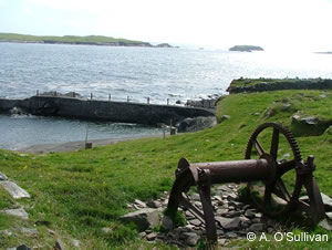
In terms of maritime heritage the histories of larger piers and jetties around the coast of Ireland are well documented. Over thirty piers or harbours were built upon the Irish coast under the direction of the Scottish engineer Alexander Nimmo. He also designed the Wellesley Bridge and docks at Limerick and well-known examples of piers include those constructed at Roundstone (Co. Galway) and Nimmo’s Pier (Galway City). Other notable landmarks include the piers and walls of Dun Laoghaire Harbour constructed in the first half of the 19th Century.
 |
| Fishing Boats in
Dingle Harbour, County Kerry |
Historically, the five Royal Harbours, Kingstown, Howth, Ardglass, Dunmore and Donaghadee were transferred to the Office of Public Works when it was set up in 1831 and at the same time the smaller harbours, piers and slips which had been administered by the Commissioners of Fisheries were also transferred. Subsequent Acts were passed, the Fisheries Act 1846 and Relief of Distress Act 1880, and also the Sea Fisheries Act 1883, which established the Fishery Piers and Harbours Commission. These Acts authorised amounts in grant aid and offered loans for building further works and extending and repairing existing works through the second half of the nineteenth century. There was considerable destitution and unemployment at this time particularly in the west of Ireland and promoting fisheries was one way in which the Administration sought to address this. Some of the costs were levied on the counties through the Grand Juries, in particular for approach roads. The establishment of the Congested Districts Board in 1891 led to further works.
By the 1890s the Board of Works listed 350 piers and harbours, many of them on the west coast and in some cases it was working with harbour boards which administered the larger harbours. The Marine Works Act in 1902 authorised further grants. In 1987, when the Department of the Marine was established, the marine division of the Office of Public Works (OPW) was transferred to it. The 1996 Harbour Act placed eight major trading ports – Dublin, the Shannon Estuary & Foynes, Cork, Waterford, New Ross, Drogheda, Galway and Dun Laoaghaire - under State companies. Rosslare is administered by CIE and Greenore by a private company. Archives held by harbour boards, port authorities, and other organisations provide important sources of information on our maritime heritage. For more information on port authorities, click here.
| |
 |
| The former Irish
Fertilizer Industry Plant at Marino Point in Cork Harbour |
The remains of the fishing industry and specific types of fisheries have left a legacy of industrial heritage around the coast. Whaling in Ireland dates back at least to the 18th century when whales were hunted commercially in Co. Donegal (Fairley, 1981). From early writings (Henry, 1739) it seems fin whales, or “huge herring hogs” were found in large numbers during the summer and as early as 1736 there were reports of abundant whales each spring in Donegal Bay. Although a fishery was encouraged, only a few whales were ever caught (Fairley, 1981). Many of these early whaling efforts were sustained by hunting basking sharks and were not commercially viable alone (Went & Ó Súilleabháin, 1967). Over 130 years later two Norwegian owned whaling stations were established in Co. Mayo (South Iniskea Island and Blacksod Bay on the Mullet peninsula) and operated between 1908 and 1922. During the 15 years of operation, 894 whales were killed within a 95-120km radius of the station. These were mostly fin whales (66%), but also blue, sei and sperm whales (Fairley, 1981).
Ireland passed the Whale Fisheries Act in 1937 in response to the formation of the International Whaling Commission. This Act repealed the Act of 1908 and whaling was forbidden in Irish territorial waters. All Irish registered vessels engaged in whaling had to be licensed and restrictions enforced such as no immature or female baleen whales were allowed to be taken and right whales were protected entirely. The few Irish-registered whaling vessels by this time were fishing in the Antarctic. Cetaceans continued to be hunted in Irish waters with reports of bottlenose whales being taken up to 1969 (Evans, 1991) and minke whales until 1976, with at least 10 Norwegian vessels fishing annually during the 10 years prior to this date (Fairley, 1981). The Wildlife Act of 1976 reinforced the Whale Fisheries Act (1937) and made it illegal to hunt or kill any cetaceans in the territorial waters of the state.
 |
| Traditional Currachs
in County Kerry |
As an island nation, trade and movement between offshore islands and
on a larger scale with the U.K., Europe and the world required boats and
boat building skills to be mastered and refined. The boat building industry
in Ireland has a long history from the earliest coracles made of wood
and leather hides, such as that made famous by St. Brendan’s Voyage
to the traditional currachs typical of Kerry, Galway and Donegal. Galway
and Connemara has a long history of boat building and produced unique
traditional boats such as the gleoiteóg, namhóg and hooker.
Galway was major boat building centre in the west in the early 19th century.
The 1836 Fisheries Inquiry Report tells us that in 1835, 20 new hookers
were built at the Claddagh with boat wrights earning three shillings plus
three glasses of whiskey a day. The fishermen themselves made and fitted
the sails and rig. The floors of the local Dominican church and courthouse
were used for cutting out sails. For more information on traditional and
heritage boats, click here.
In terms of industrial heritage, boat building at Dublin docks is well
documented and more detailed information may be obtained by clicking
here. Ringsend was a traditional centre for boat building. The Ballast
Board was optimistic that Dublin could become a major centre for shipbuilding
and repair, so in 1851 they commissioned William Dargan who is known as
the ‘father of the Irish railways’ to construct a dry dock
at the North Wall which was leased to a shipbuilding firm. Arklow
is also famous for its boat building. Over the centuries it has gained
a reputation for the skill of its craftsmen without equal in these islands.
(John Tyrrell's boatyard on the south side of the Avoca River opened in
1864 and was active until the 1990's). In 1908 the first motor powered
fishing vessel was launched at Arklow the first of its kind in these islands.
Arklow was also chosen as the location of the first RNLI station in 1826,
which is still in existence and operation today. In 1981 the same yard
also designed and built the Irish Navy's training sail vessel the Asgard
II. Other centres of boat building around the coast include Waterford,
Cobh, Baltimore, Dingle and Killybegs.
The BIM National Fisheries Training Centre in Greencastle, Co. Donegal
continues the traditional method of net mending and sea faring as well
as providing contemporary teaching of training and safety skills at sea.
The Regional Fisheries Centre (RFC) in Castletownbere, Co. Cork has become
a major focus for training and development activities in fisheries and
aquaculture in the South West.
Landscapes & Seascapes
 |
| Fishing Boats in
Letterfrack, County Galway |
Archaeological remains are present in every environment past communities
were active in, and this wide spectrum has left its mark on the maritime
zone. It is visible in the remains of settlement, defensive sites and
communication networks as well as sites associated with the exploitation
of the sea for food and fuel resources (Breen, 2004).
The monuments and features that represent these activities, when placed
in their proper setting, can be used to define and interpret ‘maritime
cultural landscapes’. Many settlements around the coast have a specific
maritime function, whether they are small fishing villages or communities
that have grown up around port or ferry sites. Quayside warehouses and
buildings, fishermen’s cottages and the material remains of these
people all reflect this identity.
Monuments associated with maritime communications are immediately identifiable,
whether they include the remains of lighthouses,
navigational aids, boats and ships as evidenced through wrecks, hulks
and floating remains, or the waterfront structures that supported them.
Sites such as harbours, quays, jetties and landing places may have been
in use for hundreds of years. Monuments such as signal and Martello towers,
coast-guard establishments, promontory forts, booms and breakwater testify
to the efforts taken to counter threats (Breen,
2004).
The European Landscape Convention which was ratified by Ireland in March
2002 acknowledges that the landscape is an important part of the quality
of life for people everywhere: in urban areas and in the countryside,
in degraded areas as well as in areas of high quality, in areas recognised
as being of outstanding beauty as well as everyday areas. The convention
notes that developments in agriculture, forestry, industrial and mineral
production techniques and in regional planning, town planning, transport,
infrastructure, tourism and recreation and, at a more general level, changes
in the world economy are in many cases accelerating the transformation
of landscapes. The anticipation of this transformation can only be achieved
through a policy led approach.
The Heritage Council pursuant to its responsibilities under the Heritage
Act, 1995, and in the light of the process outlined in its publication
‘Policy Paper on Ireland’s Landscape and the National Heritage’,
proposes a number priorities for Ireland’s landscape. The first
of those priorities requires that Government recognises the central and
positive role integrated landscape policies can play in achieving national
and international objectives by:
- acknowledging the value of having a consistent and agreed methodology
for landscape characterisation to allow effective monitoring of all policies
which impact on our landscape (including seascapes).
- identifying a central agency which will be adequately resourced to complete
and maintain a programme of national landscape characterisation in an
18-month period. This will in particular complement the work of local
authorities in the exercise of their functions under the Planning and
Development Acts.
More information on the importance of landscapes and seascapes can be
found on The Heritage Council website by clicking here.
 |
| Ruin on Beach at
Rostellan woods, County Cork |
The Record of Monuments & Places, the RMP is a database recording all archaeological sites in Ireland known to the National Monuments Service established under Section 12 of the 1994 National Monuments (Amendment) Act. It is based on Ordnance Survey 6” sheets, which indicate the location of each monument or place of archaeological interest. For each, a file contains further documentary and photographic data or information relating to an archaeological event such as a site visit, survey or excavation. These are housed in the National Monuments Services in Dublin. The record is constantly updated and focuses on monuments that pre-date 1700. The archive also has all the Urban Archaeological Surveys. For more information on the Record of Monuments & Places, click here.
| |
The following areas of responsibility are included in the brief of the NMS:
- The Planning and Development Act 2000 recognizes that proper planning and sustainable development includes the protection of the archaeological heritage. Development plans may include such objectives and conditions relating to archaeology may be attached to individual planning permissions.
- A planning authority must refer all planning applications, which might affect or be unduly close to any archaeological site, monument or feature, to the Minister for the Environment, Heritage and Local Government.
- Development Applications Unit of the NMS co-ordinates the Department's evaluation of all proposals for development referred by Local Authorities. The planning application is examined with reference to known archaeological sources and an appraisal is made as to whether the development is likely to affect archaeology and to what degree. On the basis of this appraisal the Department may respond to the planning authority by requesting an archaeological assessment or by making a recommendation for the inclusion of planning conditions. In extreme case where serious damage may not be mitigated the Department can recommend that planning permission not be granted.
- Development Applications Unit may recommend that an archaeological excavation be carried out.
- The National Monuments Service is the licensing authority for all archaeological excavation, which can only be carried out by qualified and registered archaeologists. A database of excavations maintains details of all excavations carried out in Ireland together with a large archive of excavation reports. Excavations at the moment exceed 1000 per annum.
- Many important or threatened archaeological sites that are not in the ownership of the State are specifically protected under legislation from damage or interference.
- The OPW manages over seven hundred major archaeological monuments in state ownership or state guardianship under the National Monument Acts.
The National Museum of Ireland is the repository for all archaeological artefacts. The discovery of artefacts can be an important indicator of past levels of activity in an area and therefore a useful guide to the archaeological potential of a site. The National Museum in Dublin houses a national archive of antiquities cataloguing artefacts, which were found and reported between 1928 and 1995. They are catalogued by year and accession number. These archives are open to researchers through appointment only. For more information on times and booking see the following link.
Every person who finds any archaeological object in Ireland is bound by law, through the National Monuments Acts (1930 as amended in 1954, 1987, 1994) to make a report of such finding within four days to a member of the Gárda Síochána on duty in the district in which such object was found or to the Director of the National Museum (or designated agent of the Director). Every person who finds an archaeological object and fails without reasonable excuse to make a report of such shall be guilty of an offence under the aforementioned Acts. For the full text of the National Monuments Acts, the reader is referred to the Irish Statute Book. Simply, if a person finds what they suspect may be an archaeological feature or artefact on the beach or foreshore, they should contact the Duty Officer at the LoCall number listed below or e-mail the museum at the antiquities section.
National Inventory of Architectural Heritage (NIAH)
 |
| Gallarus Oratory,
County Kerry |
- Provide a source of guidance for the selection of structures for protection.
- Supply data to local authorities, which helps them to make informed judgments on the significance of building stock in their functional area.
- Foster greater knowledge and appreciation of Ireland's architectural heritage.
The website ‘Buildings of Ireland’ is the on-line representation of the survey work of the NIAH. Surveys are presented by county, and consist of a database record and images of each building/structure surveyed. These surveys are ongoing and the site will be updated with new survey material regularly. A number of the new format surveys are available online while the old paper format are generally available in the local history section of the County Library. Most of the old format paper surveys and new format CD ROM surveys are housed in the ENFO library. To go to the NIAH website, click here. NIAH Publications:
- NIAH Town Surveys: (Paper format)
Ballina ,Carrick on Shannon, Cavan, Clonmel, Ennis, Galway, Kilkenny, Letterkenny, Longford, Monaghan, Portlaoise, Roscommon , Roscrea, Sligo, Tullamore & Wicklow - NIAH Town Surveys (CD ROM):
Navan,& Athy, Tralee (2003) - NIAH Interim County Surveys (Paper format):
Clare (2000)
These should be available for consultation in the relevant local authority offices, public library and copyright libraries. - NIAH Interim County Surveys (new format):
Laois (2002), Carlow (2002), Fingal (2002), Kerry (2003), South Dublin (2002), Kildare (2003), Meath (2003), Waterford (2004), Leitrim (2004), Wicklow (2004), Wicklow (2004).
Surveys currently available on the NIAH website are Carlow, Kildare, Leitrim, Meath, Roscommon, South Dublin County, Waterford and Wicklow. It is intended that counties Kerry, Fingal and Laois will be added to the website in 2005. - NIAH Surveys to be published in 2005 are Kilkenny, Offaly, North Tipperary, Westmeath & Sligo. The survey of Cork Inner City will also be published in 2005.
- Surveys to be carried out in 2005 and published 2006 are South Tipperary, Wexford, Limerick City, Louth & Longford
 |
| Underwater Archaeology
- work with suction dredge on ship wreck |
The Underwater Archaeology Unit is part of the heritage and planning division of the Department of the Environment, Heritage & Local Government. Its main duties involve: compiling and publishing an inventory of shipwrecks around our coast; advising on applications to remove or to dive on wrecks; assessing development-related impacts on underwater archaeological sites; undertaking archaeological surveys of wreck sites in order to assess their nature and condition and to devise appropriate management strategies for them; and examining threats to underwater sites when reported and assisting the Garda Síochána in carrying out its role. The Underwater Archaeology Unit has a staff of three archaeologists who are proficient in diving. Excluding salaries and travel and subsistence, the unit has a budget to cover equipment, survey work, dive bursaries for the training of external archaeologists and other expenditure. The Underwater Unit houses two main archives with relevance to the coastal zone:
- Ports & Harbours Archive – this contains all alterations and refurbishment works including OPW works carried out on ports and harbours, it contains dates and inquests in to the state of Irish fisheries since the 19th Century.
- Shipwreck Inventory – this is based on archival studies of all documentary sources around the coast including Lloyd’s List, House of Commons Sessions Papers, Local Newspapers, Cartographic Sources and all other relevant documentary sources. The Inventory will be published in four volumes: Vol. I – Louth to Wicklow in 2006 and subsequently Vol. II – Wexford & Waterford, Vol. III – Cork and Vol. IV - Kerry to Donegal.
The Underwater Unit may be contacted and appointments made to view archives through the National Monuments Service.
 |
Submerged Prehistoric Forest |
- Coastal landscapes and environmental change
- Neolithic submerged forests, red deer bone and a coastal wetland occupation site
- A Bronze Age house and trackway in coastal wetlands
- Early historic and medieval fishtraps
- Post-medieval and modern fishtraps
- A post-medieval shipwreck, harbours and lighthouses
- People place and time on the Shannon Estuary
Geological
Survey of Ireland – GSI (Aerial Photography)
Aerial photographs are an invaluable resource in archaeology for the recognition
of new sites and contributing to the understanding of known sites. Features
can be recognised from the air as earthworks in relief or as vegetation
marks where a buried feature such as a wall or ditch affects the growth
of the surrounding flora. The Geological Survey of Ireland Aerial Photograph
Collection, based in Dublin, holds a comprehensive archive of high-level
vertical photographs available for consultation by the public and researchers
but may not be copied. There is a fee for map consultation. For more information
on the aerial photograph collection of the GSI, click here.
National Coastline Survey - Marine Institute & DCMNR
The National Coastline Survey provides a comprehensive package of over
7000 digital pictures on CD ROM containing essential ‘information
in image’ of Ireland's coastal resource. Ireland’s coastal
zone contains a wealth of natural resources which have economic, social,
cultural and environmental value. The highly sensitive nature of the coastal
zone is increasingly subject to pressures resulting from multiple use.
The National Coastline Survey CDs provide the visual information needed
to assist in the effective and sustainable management of the coastline
and coastal resources. Potential uses include mapping coastal erosion,
urban expansion and tourism developments (caravan sites, golf courses,
etc). The resource can also be used to identify large historic features
in the coastal zone such as earthworks or field systems. For more information
on the National Coastline Survey, click here.
 |
Inishark, Old Harbour, County
Galway |
FOLKLORE & FOLKLIFE
IN THE COASTAL ZONE
TRADITIONAL AND HERITAGE BOATS
ORGANISATIONS
ARCHIVES, SOCIETIES, BIBLIOGRAPHIES
REGIONAL SOURCES
RESEARCH PROJECTS
- oral traditions and expression including language as a vehicle of the intangible cultural heritage;
- performing arts;
- social practices, rituals and festive events;
- knowledge and practices concerning nature and the universe;
- traditional craftsmanship.
Until very recently, in historical terms, every aspect of the knowledge and skills involved in living in these zones was transmitted aurally, orally and by imitation. Across the wide range of human activities, from the naming of places and physical features, and the flora and fauna within them, to boat-building and fishing lore, to customs and beliefs, stories and songs and music, people’s lives by the sea were guided and informed by tradition. The collection and documentation of traditional materials only began in the nineteenth century. Interpretation of the materials as a resource for the greater understanding of people’s lives and history is a very recent phenomenon. The definition and perception of folklore and folklife in Ireland can vary from county to county. For further clarification please contact you local Heritage Officer.
 |
Currachs, County Galway |
Traditional and heritage boats such as hookers, púcáns, gleoiteógs, trawlers, schooners, steam and motor vessels are associated with the maritime heritage of many of Ireland's coastal counties. However, heritage and traditional boats are not well documented and their value is not generally appreciated. Some publications are available on particular boat types, see the references in ‘selected reading’ below. There is no definitive difference between a traditional boat and a heritage boat. In a survey carried out by the Heritage Council, boats were assessed under the following categories:
- Boats or vessels that were important to inland or coastal communities,
- Boats built with materials available at the time, i.e. timber, iron, steel, concrete or GRP and that reflected the techniques and skills used in the construction of that boat,
- Boats or vessels with historic connections of national importance, or associated with prominent national persons.
To date the preservation of Ireland’s boats, be they working or
leisure boats, are an aspect of heritage that has not received much official
support. Much work in recording and maintaining these boats has been carried
out by voluntary groups and individuals while information and examples
of boats have been collected by institutions such as the Dept of Irish
Folklife in UCD and the National Museum of Ireland.
The Heritage Council became concerned about Irish boats, both inland and
sea-going, as a neglected aspect of our heritage. To inform itself, the
Council commissioned a scoping study of the heritage boat sector in autumn
2003, details of which can be found on the website of the Heritage
Council. Arising from this study the Council decided to host a seminar
on Ireland’s boats in Tullamore on 13 November 2004, bringing people
together from all around Ireland. Recommendations arising from this event
were included in the section on boats in its 2005 policy paper on marine
heritage. A short list of contact details of some organisations involved
in preserving and promoting the heritage of Irish Traditional Boats can
be viewed by clicking here.
The Heritage Council’s overall intention is to lobby, propose policy,
and to raise awareness of Ireland’s boats as an important part of
our nation’s heritage, under its responsibilities as outlined in
the Heritage Act
1995.
 |
Boat in Cork Harbour |
Roinn Bhéaloideas Éireann / Department of Irish Folklore - UCD
In addition to its academic function, the Department of Irish Folklore at UCD also administers the Irish Folklore Collection. In 1971 the Department was set up and took over the role and work of The Irish Folklore Commission, which had been established in 1935. Under the auspices of the Commission and the Department much of the folklore of Ireland has been saved for future generations.
As outlined in Seán Ó Súilleabháin’s ‘A Handbook of Irish Folklore’ (1971), folklore is afforded a broad definition in the Department of Irish Folklore, and refers not only to all aspects of folk narrative tradition, custom and belief, foodways and social tradition, but also to the entire field of material folk culture, as well as that of music, song and dance. The library collection reflects this broad definition and incorporates published material in Irish and English, part of which is of direct relevance to linguistics and onomastics.
The Irish Folklore Collection consists of Manuscript, Photographic and Audio/Visual archives, a specialist Library, and a Folk Music section. The Collection contains approximately three million manuscript pages (traditions recorded all over Ireland by full- and part-time collectors), a three hundred thousand-item card index and other computerized indices, thousands of hours of audio recordings (including wax cylinders), approximately 70,000 photographs and drawings, and a collection of paintings. The specialist library contains some 50,000 printed books, periodicals and offprints relating to Irish and comparative folklore, ethnology and related fields. Information regarding aspects of the folklore and folklife of every county in Ireland is contained in the Collection, as well as some material collected in Scotland, the Isle of Man and the USA. The Collection contains much material pertaining to every aspect of life in the marine and coastal zones. Material is indexed by location, collector, informant and topic and the main headings are as follows:
- Settlement and Dwelling
- Livelihood and Household Support
- Communication and Trade
- The Community
- Human Life
- Nature
- Folk Medicine
- Time
- Principles and Rules of Popular Belief and Practice
- Mythological Tradition
- Historical Tradition
- Religious Tradition
- Popular ‘Oral Literature’
- Sports and Pastimes
For more information on the Irish Folklore Collection, click here.
Contact:
Department of Folklore,
John Henry Newman Building,
University College Dublin,
Belfield,
Dublin 4.
Telephone: 01 7168436
Fax: 01 7161144
Web: http://www.ucd.ie/irishfolklore/english_html/english_home.htm
Department of Community, Rural and Gaeltacht Affairs
The Department retains the responsibilities previously held by the former Department of Arts, Heritage, Gaeltacht and the Islands for the Irish language, the Gaeltacht and the development of Ireland’s offshore Islands.
The Irish language is a vital part of the living heritage of the State and an important natural resource in the Gaeltacht. A core task of the Department is to promote the cultural, economic and social welfare of the Gaeltacht as the main source of the living language; the reversal of the decline of Irish as the principal means of communication in the Gaeltacht; and the extension of its use in the rest of the country, both North and South. For more information on the Irish Language, click here. For more information on the Irish Language and its history see Buttimer, 2000.
| |
A core task of the Department is to promote the social, physical and economic development of Gaeltacht areas and to strengthen Irish as the principal community language in the Gaeltacht, particularly in terms of passing the language from one generation to the next. The Department seeks to achieve these objectives both through its own programmes and schemes and those of the bodies under its aegis. The key underlying objective of Government policy in this regard is to maintain the primacy of the Irish language and its related culture in the Gaeltacht. For more information on the Gaeltacht, click here.
 |
| Road emerges at
low tide to Omey Island, County Galway |
Our coastal islands are an integral part of the state's heritage. Around 30 of these coastal islands are inhabited and they possess a valuable cultural heritage. It is a central purpose of the Department that sustainable vibrant communities will continue to settle on the islands. There is a need to provide satisfactory services and a developed infrastructure in order to ensure the sustainability of the islands. The Department's aim is to seek to meet the requirements through current capital investment via the Department and other relevant Departments and organisations. The Department has given priority in recent years to the development of island infrastructure as well as subsidising comprehensive access services. For more information on Ireland’s coastal islands, click here. There are many books available on the islands around Ireland’s coast some of which are listed in the references below.
The
National Library of Ireland
The Museum Department of the National Library holds photographic
albums donated by John de Courcy Ireland. The photographs were taken by
the donor and cover the period 1950-1990.
Contact:
The National Library of Ireland,
Kildare St.,
Dublin 2.
Telephone: 01 6030 200
Fax: 01 6766 690
e-mail: info@nli.ie
Web: www.nli.ie
The National Photographic Archive
 |
Tacumshane windmill built in
1846- one of the last three intact Irish windmills, County Wexford |
- The Commissioners of Irish Lights Collection – this reflects the interest and work of the Commissioners between 1900-1905, including the construction of lighthouses.
- The Congested District Board Collection – this covers the development of the fishing industry in the west of the country and the construction of safe harbours at locations such as Killybegs.
- The Spillane Collection – a small collection, which has a few images of pollock and lobster fishing.
- The Panoramic Photograph Album – features coastal scenes around Ireland, taken in 1906.
- Lawrence, Valentine and Eason Collections – topographical collections which cover coastal areas between 1880-1960.
- John Eagle’s set of Irish Lighthouse postcards – 96 postcards covering all the lighthouses in the country, available for reference only.
Contact:
National Photographic Archive
Meetinghouse Square,
Temple Bar,
Dublin 2.
Telephone: 01 6030 374 (visitors), 01 6030 371 (collections)
Fax: 01 6777 451
Web: http://www.nli.ie/new_archive.htm
e-mail: photoarchive@nli.ie
National
Museum of Ireland – Museum of Country Life
The National Museum of Ireland – Country Life is home to the Irish
Folklife Division of the Museum. This Division is responsible for the
care of the National Folklife Collection, which comprises 50,000 objects.
These collections reflect Irish traditional life, largely of a rural nature,
from 1850-1950. There are good displays on the craft of inshore and offshore
fishing, vernacular boats, and also on the beliefs, customs and superstitions
associated with this way of life. The museum has Education and Outreach
programmes, which include guided tours, workshops and demonstrations and
lectures. The Irish Farmers’ Association Library and Archive is
located in Turlough Park House and is a center for the study and research
of folklife.
 |
| Glencolumbkille,
County Donegal - Historic Village |
Museum of Country Life
Turlough Park,
Castlebar,
Co. Mayo.
Telephone: 094 90 31755
Fax: 094 90 31628
Web: www.museum.ie/countrylife;
e-mail: tpark@museum.ie
Contact: Dr. Séamas Mac Philib, smacphilib@museum.ie
Taisce Cheol Dúchais Éireann / Irish Traditional Music Archive
Established in 1987, the Irish Traditional Music archive is an archive and a resource and study centre for the traditional song, instrumental music and dance of Ireland. The archive contains sound recordings, books, manuscripts, sheet music, periodicals, photographs and other illustrations, films, videos, musical instruments, and ephemera such as posters, newspaper clippings etc. (2004 list of holdings: 21,600 commercial and non-commercial sound recordings; 22, 500 printed items; 9,950 photographs; 1,100 videos and DVDs.). There is a wealth of material pertaining to the marine and coastal zones and materials are easily accessed under a number of categories, including topic and location.
Contact:
Irish Traditional Music Archive
63 Merrion Square,
Dublin 2.
Telephone: 01-661 9699
Fax: 01-662 4585
Website: www.itma.ie
Contact: Nicholas Carolan, Director
An Cumann le Béaloideas Éireann / The Folklore of Ireland Society
The Folklore of Ireland Society was established in January 1927. The object of the Society, as stated in the editorial of the first issue of its journal Béaloideas, which appeared in June 1928, is to collect, preserve and publish the folklore of Ireland. The journal Béaloideas continues to be published regularly and contains many articles on traditions associated with the marine and coastal zones. Articles may be accessed by clicking here. In addition, the Society has also produced other publications and it sponsors a series of lectures on folklore and related topics each year.
Contact:
The Folklore of Ireland Society
c/o The Department of Irish Folklore,
University College Dublin,
Belfield,
Dublin 4
Telephone: 01 7168436
Fax: 01 71661144
Web: http://www.ucd.ie/irishfolklore/
Bibliomara
 |
| Shells and Seaweed |
BiblioMara is a project that was initiated and funded by the Heritage
Council of Ireland. The aim of the project was to create a comprehensive
annotated indexed bibliography of cultural and maritime heritage studies
of the Irish coastal zone. The research team engaged in the work on the
BiblioMara included: the Coastal & Marine Resources Centre (UCC) (Project
Coordinators), the Department of Béaloideas (UCC) and Meitheal
Mara (Cork).
The scope of the BiblioMara Bibliography is currently limited to references
related to cultural and built heritage, with inclusion of references related
to human activities in the coastal zone (inclusive of technical reports
- e.g. fishing policies, Coastal Zone Management, etc.). References related
to natural heritage (e.g. geology, physical geography, biology, etc.)
and purely scientific references (e.g. biological works on distribution
of particular species) are currently out of the scope of the BiblioMara
project. The BiblioMara Bibliography 2004 edition contains 2964 references,
which can be browsed in PDF or DATABASE format. For more information and
to browse BiblioMara, click here.
The Schools’ Manuscript Collection consists of 1,128 bound and paginated volumes, in addition to an estimated 40,000 unbound original copybooks. This Collection stems from the Schools’ Scheme of 1937-38, organised in twenty-six of the thirty-two counties of Ireland. The collecting scheme was carried out by children, c. 11-14 years of age, in Primary schools under the direction of their teachers, who followed specially prepared guidelines.
 |
County Libraries
County Libraries have local collections of books and articles. For contact details of County Libraries click here or on the following links.
Clare - http://www.clarelibrary.ie/
Cork - http://www.library.ie/public/corkco.shtml
Donegal - http://www.donegallibrary.ie/
Dublin - http://www.iol.ie/dublincitylibrary/
Dun Laoghaire Rathdown - http://www.dlrcoco.ie/library
Fingal – http://www.iol.ie/~fincolib/
Galway – http://www.galwaylibrary.ie/
Kerry - http://www.kerrycolib.ie/
Leitrim - http://www.leitrimcoco.ie/Services/Library/library.htm
Louth - http://www.louthcoco.ie/louthcoco/louth/html/library.htm
Mayo - http://www.mayo-ireland.ie/Mayo/CoDev/MayoLibs.htm
Meath - http://library.meath.ie/
Sligo - http://www.sligococo.ie/
Waterford - http://www.waterfordcountylibrary.ie/index.html
Wexford - http://www.wexford.ie/Library/
Wicklow - http://www.wicklow.ie/LIBRARIES/librariesindex.htm
Local Heritage and Interpretative Centres & Museums
These resource centres often have material and information on
folklore and folklife topics. The Heritage
Officer with the Local
Authority should be able to advise on these.
Ulster Folk and Transport Museum
The Ulster Folk and Transport Museum illustrates the way of life
and traditions of the people of the north of Ireland. The award winning
galleries of the Transport Museum display Ireland's most comprehensive
transport collections from horse drawn carts to Irish built motor cars,
from the mighty steam locomotives which graced the Irish railways to the
history of ship and aircraft building.
Contact:
Cultra,
Hollywood,
Co. Down,
BT18 OEU,
N. Ireland.
Telephone: 048 9042 8428
Web: www.uftm.org.uk
Meitheal Mara
 |
| Currach at Roches
Point in Cork Harbour |
Contact:
Meitheal Mara
Crosses Green House,
Cork.
Telephone: 021 4316813
Web: www.mmara.com
Ionad na hImirce - Irish Centre for Migration Studies
This Centre promotes the study of historical and contemporary
migration, to and from Ireland. The Centre commissioned, facilitated and
houses the Breaking the Silence Life Narrative Collection. This comprises
a collection of 90 narratives with supporting information, focusing on
memories of emigration and its effects on families and local communities
in Ireland, mainly during the 1950s, but with some memories going back
to the 1910s and 1920s. All original material is deposited in the Boole
Library, the National University of Ireland, Cork. 50 life narratives
with appropriate copyright are published on the project website.
Contact:
Irish Centre For Migration Studies,
University College Cork.
Telephone: 353 21 4902889
e-mail: migration@ucc.ie
Web: www.migration.ucc.ie
Comhar Dún Chaocháin
Is comhlacht forbartha pobail é Comhar Dún Chaocháin
Teo. a bunaíodh sa bhliain 1995. Is ceantar Gaeltachta i dtuaisceart
Mhaigh Eo é an ceantar seo. Is é an phríomhaidhm
atá ag Comhar Dún Chaocháin cúrsaí
eacnamaíochta, sóisialta agus cultúrtha na háite
a fhorbairt agus a chur chun cinn. Tá clár leathan imeachtaí
idir lámha ag an gcomharchumann. I measc na dtograí cultúrtha
a tionscnaíodh tá féilte cultúrtha, foilseacháin
oidhreachta, comharthaíocht agus cláranna eolais do thurasóirí
agus forbairt siúlóidí. Is mian leis an gcomharchumann
an cultúr agus an tírdhreach aiceanta a cheiliúradh
agus a úsáid mar acmhainn in athnuachan an phobail, go cultúrtha
agus go heacnamaíoch. Is cuid shuntasach d’oidhreacht an
cheantair an fharraige agus an saol traidisiúnta a ghabhann léi.
Comhar Dún Chaocháin Teo is a community development company
which was founded in 1995. Dún Chaocháinn is a Gaeltacht
area in North Mayo. The group’s main aim is to develop and improve
the area’s economic, social and cultural life. They have undertaken
a wide range projects. Among the cultural projects are, festivals, heritage
publications, signage and information boards for visitors, as well as
developing walks. Comhar Dún Chaocháin wish to celebrate
and use the local landscape and traditions in the renewal of the community,
both culturally and economically. A very significant part of the area’s
heritage is involved with the sea and the traditions associated with it.
Foilseacháin oidhreachta Chomhar Dún Chaocháin:
Comhar Dún Chaocháin’s heritage publications:
- Dún Chaocháin (CD Rom) – Tugann an togra seo léargas,
tríd na logainmneacha, ar oidhreacht Dhún Chaocháin.
Tá 1,500 logainm curtha ar mhapa (agus míniú agus
cur síos beacht, fuaimeanna, agus grianghraif leo), chomh maith
le scéalta agus amhráin an cheantair. Áis eolais
foghlamtha agus taighde atá ann don phobal is leithne.
(CD Rom Dún Chaocháin – This project gives an insight, through the placenames, into the heritage of Dún Chaocháin. 1,500 placenames have been mapped (accompanied by their meanings, pronunciations, and photographs), as well as traditional stories and songs from the area. In addition to being a local resource, the CD Rom serves as a source of information and research for the wider community.) - Logainmneacha agus Oidhreacht Dhún Chaocháin I mBarúntacht
Iorrais, Co. Mhaigh Eo – The Placenames and Heritage of Dún
Chaocháin in the Barony of Erris, Co. Mayo - Uinsionn Mac Graith
agus Treasa Ní Ghearraigh, ISBN 0-9548021-0-1. Déanann
an leabhar seo cur síos ar an saibhreas béaloidis agus
oidhreachta atá le fáil i nGaeltacht Dhún Chaocháin,
idir logainmneacha, an cultúr ábhartha, an seanchas, agus
na creidimh agus na nósanna traidisiúnta. Tugtar aird
ar leith ar an eolas traidisiúnta a bhaineann le hiascaireacht
agus bádóireacht.
(Logainmneacha agus Oidhreacht Dhún Chaocháin I mBarúntacht Iorrais, Co. Mhaigh Eo – The Placenames and Heritage of Dún Chaocháin in the Barony of Erris, Co. Mayo - Uinsionn Mac Graith agus Treasa Ní Ghearraigh, ISBN 0-9548021-0-1. This book shows the rich folklore and heritage of the Dún Chaocháin Gaeltacht; placenames, material culture, oral tradition, and traditional beliefs and customs. Special attention is given to the traditional lore connected with fishing and boating.)
Contact:
Comha Dún Chaocháin,
Ceathrú Thaidhg,
Béal an Átha,
Co. Mhaigh Eo.
Telephone: 097 88082
e-mail: caochan@eircom.net
Meitheal Mhaigh Eo
Meitheal Mhaigh Eo is a partnership company in Mayo, which works
to promote social inclusion. Meitheal Mhaigh Eo is organised around a
central area partnership office in Foxford. It is responsible for a number
of different development initiatives. One of these initiatives includes
the Clew Bay Heritage and Folklore Scheme, which is a local training initiative
based in Castlebar Co. Mayo. The purpose of the scheme is to record and
analyse the oral heritage of the area, and to train the participants in
the art of this recording. The participants will receive rigorous training
before going out into the field, and before undertaking detailed analysis
of the folklore and song orally transmitted down through the generations.
The material collected will be collated and archived in an effort to provide
a detailed record of the traditional heritage of the Clew Bay area.
Contact:
Meitheal Mhaigh Eo
Lower Main Street,
Foxford,
Co. Mayo
Telephone: 094 9256745
Fax: 094 9256749
e-mail: meithealm@eircom.net
NUIG – Studies in Irish
Áras na Gaeilge at the National University of Ireland,
Galway, is a modern centre - a strong mini-Gaeltacht which promotes Irish
and Irish culture, which serves the Irish-speaking community in the University
and in the city, and which supports the Irish language through various
educational, training and social activities. Part of the course in Irish
includes a module on folklore.
Contact:
IRISH DEPARTMENT,
ÁRAS NA GAEILGE,
National University of Ireland Galway,
University Road,
Galway,
Ireland.
Telephone: 091 524411 Ext: 2564;
Fax: 091 750522
e-mail: fiona.depaor@nuigalway.ie
Web: http://www.nuigalway.ie/faculties
departments/gaeilge/arasnagaeilge/index.html
Archaeology
and Built Heritage in the Coastal Zone
Arklow Industrial
Heritage - http://www.arklow.ie/history.asp
Dublin Docklands -
http://www.dublindocklands.ie/cold_fusion/dublin_docklands/what_is_it/what_is_it.cfm
National Monuments (Amendment) Act 1994 - http://www.irishstatutebook.ie/ZZA17Y1994.html
NIAH
surveys are available online at www.buildingsofireland.ie
National Monuments
Service - http://www.heritagedata.ie/en/
National Museum -
http://www.museum.ie/
National Coastline
Survey -
http://kryton.clickandbuild.com/cnb/shop/themarineinstitute?op=catalogue-categories-null
Geological Survey
of Ireland - http://www.gsi.ie/organisation/org-frame.htm
Policies and Priorities for
Ireland's Landscape - http://www.heritagecouncil.ie/publications/landscape/p7.htm
Policy Paper on Ireland's
Landscape and the National Heritage (with mention of seascapes) - http://www.heritagecouncil.ie/publications/landscape_heritage/index.html
Commissioners
of Irish Lights - http://www.cil.ie/
Index
of Lighthouses & Lightships on the Web - http://www.maine.com/lights/links.htm
Discovery
Programme - http://www.discoveryprogramme.ie/controller?action=groups_home
Bibliomara
- http://bibliomara.ucc.ie/Web/Index.htm
Irish
Language - http://www.pobail.ie/en/IrishLanguage/
Gaeltacht - http://www.pobail.ie/en/AnGhaeltacht/
Ireland's
coastal
Irish Folklore
Collection - http://www.ucd.ie/irishfolklore/english_html/manuscriptmain.htm
Heritage
Council - http://www.heritagecouncil.ie/index.html
The Schools' Manuscript Collection
- http://www.ucd.ie/irishfolklore/
County
Sean
O Súilleabhain's A Handbook of Irish Folklore - http://www.ucd.ie/irishfolklore/english_html/manuscripts.htm
National
Irish
Centre for Migration Studies - http://migration.ucc.ie/oralarchive/
Other
URLs of Interest:
Irish Field Monuments
- http://www.environ.ie/DOEI/DOEIPol.nsf/0/
c482804d1d7ed85980256de4004092ad/$FILE/Englishbook.pdf
Irish Underwater Council (CFT)
Guidelines for divers: - http://www.scubaireland.com/downloads/DCC.pdf
Bibliomara - http://bibliomara.ucc.ie/index.htm
Archaeology
and Built Heritage in the Coastal Zone
Aalen, F.H.A., Whelan, K. & M. Stout (Eds).2000. Atlas of the Irish
Rural Landscape. Cork University
Press.'
Anonymous.' 2004. Architectural Heritage Protection - Guidelines for Planning Authorities.Government of Ireland Publication.
Bourke, E.J. 1994, 1998, 2001.' Shipwrecks of the Irish coast.' Vols 1, 2 & 3. Dublin.
Breen, C. & Forsythe, W. 2004.Boats and Shipwrecks of Ireland.Tempus, Gloucestershire.
Buttimer, N., Rynne, C. & H. Guerin (Eds). 2000. The Heritage of Ireland - Natural Man-made and Cultural Heritage, Conservation and Interpretation, Business and Administration.' The Collins Press, Cork.'
Condit, T. 1991. Archaeology. In K. Bradley, C. Skehan and G. Walsh (eds), Environmental Impact Assessment: A technical approach, 110-6. Dublin: DTPS Environmental Publications.
Corlett, C. 2001. Antiquities of West Mayo. Wordwell, Bray.
Dean, M., Ferrari, B., Oxley, I., Redknap, M. & K. Watson (Eds).Archaeology Underwater - The NAS Guide to Principles & Practice.' Nautical Archaeological Society, Dorset Press, Dorchester.
Desmond, A., Johnson, G., McCArthy, M., Sheehan, J. & E. Shee Twohig (Eds).' 2000. New Agendas in Irish Prehistory. Wordwell, Bray.
Fairley, J.S. 1981. Irish Whales and Whaling. Blackstaff Press, Belfast.
Flanagan, L. 1988. Ireland's Armada Legacy. Gill & Macmillan, Dublin.
Hamond, F. & M. McMahon. 2002.' Recording and Conserving Ireland's Industrial Heritage - An Introductory Guide. The Heritage Council, Kilkenny.
Harbison, P. 1970. Guide to the National Monuments in the Republic of Ireland.' Gill & Macmillan, Dublin.'
Henry, W. 1739. Hints towards a Natural and Typographical History of the Counties Sligoe, Donegal, Fermanagh and Lough Erne. Public Record Office, Dublin. Ms M2533, cited from Fairley (1981).
Herity, M. & G. Eogan. 1989.' Ireland in Prehistory.' Routledge, London.
Killanin, (L) & M.V. Duignan. 1995.' The Shell Guide to Ireland.' Gill & Macmillan, Dublin.'
Macalister, R. 1996. The Archaeology of Ireland. The Guernsey Press Co., Guernsey.
Mac Carthaigh, C. & K. Whelan. 1999.' New Survey of Clare Island - Volume I: History and Cultural Landscape. Royal Irish Academy, Dublin.
McNeill, T. 1997. Castles in Ireland - Feudal Power in a Gaelic World.' Rutledge, London.
Nairn, R. 2005. Ireland's coastline - Exploring it's nature and heritage.' Collins Press, Cork.'
Nolan, W. & A. Simms (Eds). 1998.' IRISH TOWNS. A guide to sources.' Geography Publications, Dublin.'
O'Cróinín, D.' 1995. Early
O'Sullivan,
Ryan, M.1991. The Illustrated Archaeology
of Ireland. Country House, Dublin.
Stout, M.2000. The Irish Ringfort.' Four Courts Press, Dublin.
Waddell, J. 2000. The Prehistoric Archaeology
of Ireland. Wordwell, Bray.
Went, A.E.J. and O Súilleabhain, S. (1967) Fishing for sun-fish or basking sharks in Irish waters. Proceedings ofthe Royal Irish Academy 65C, pp. 91-115.'
Folklore and FolklifeBreen.C., and Forsythe, W. 2004. Boats and Shipwrecks of
Buttimer,
N. 2000. The Irish Language. In:
The Heritage of Ireland. The
Collins Press, Cork.
Danaher,
K. and Lysaght, P. 'A Supplementary
Bibliography of Irish Ethnology and Folk Tradition' in Béaloideas,
Vol. 48-49, 1980-81, 206-227
De Bhaldraithe, P. 2000. Translation of The Shores
of Connemara by Seamus Mac' an Iomaire. Tír Eolas. Kinvara.
Heritage Council.
2005.
Hornell, J. 1938. British Coracles and Irish Currachs. Society for Nautical Research
MacPolin, D. 1999.
The Drontheim - Forgotton Sailing Boat of the
McInerney, J. 2005.
The Gandelow - a Shannon Estuary Fishing Boat.
O Danachair, Caoimhín. 1978. A Bibliography
of Irish Ethnology and Folk Tradition, Cork.'
O Suilleabhain, Sean. 1971. 'A Handbook
of Irish Folklore'.
Quinn,
Bob. 2005.' The Atlantean Irish, Ireland's Oriental and
Maritime Heritage. The Lilliput Press,
Ritesma,
Wilkins, N. 2001, Squires, Spalpeens and Spats,
Oysters and Oystering in