COASTAL CHARACTERISTICS & RELATED HERITAGE
 |
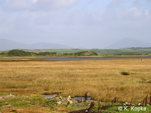
Nohoval Coastline,
County Cork |
This section of the Directory addresses various types of coastline in
terms of its distinguishing attributes or characteristics otherwise referred
to as Habitat Types. It starts with a general definition of the coastal
zone and the processes that help shape it. Each characteristic habitat
type as outlined in Boelens et al., 1999 is
then discussed in terms of natural heritage and then built heritage found
in that habitat. For a more detailed guide to coastal habitats, the reader
is referred to that section in The Heritage Council ‘Guide to Habitats’
(Fossitt,
2000). Habitat types in the coastal zone are described under two headings;
Coastal Fringe Habitats and Intertidal Habitats. These two categories
are further sub-divided as follows:
Dune Systems |
Saltmarsh |
Lagoons |
Intertidal Sand & Mudflats |
Rock Cliffs |
Rocky Shores |
Glacial Cliffs |
Sandy Shores |
Shingle Shores |
|
Other Habitats |
The coast is where land, water and air meet. This triple conjunction is further complicated by the fact that the water may be fresh or salt. The coast is best viewed as a zone of mixing or adjustment (Carter, 1999). A more formal definition of the coastal zone put forward by Carter is as follows:
- ‘The Coastal Zone is that space in which terrestrial environments influence marine environments and vice versa. The coastal zone is of variable width and may also change in time. Delimitation of zonal boundaries is not normally possible, more often such limits are marked by an environmental gradient or transition. At any one locality the coastal zone may be characterised according to physical, biological or cultural criteria. These need not, and in fact rarely do, coincide’.
The East coast of Ireland from Carlingford in the North to Carnsore Point in the South is c. 450km in length and is comprised predominantly of long stretches of sandy beaches, see (Boelens et al., 1999). The southeast coast from Carnsore Point to Mizen Head is much more rocky and indented. The southwest coast is very rocky and divided into a series of large bays and inlets that provide a degree of shelter from the prevailing southwesterly winds and large Atlantic waves. To the South in Counties Cork and Kerry, there is an area of long narrow inlets (drowned valleys or rias) separated by mountainous peninsulas.
 |
Sandy Beach at Lahinch,
County Clare |
From Tralee Bay to Galway Bay there are stretches of more linear coastline with some long sandy beaches, although the foreshore remains predominantly rocky with steep cliffs in many areas. North of Galway Bay the shoreline is once more highly indented and characterised by an irregular series of rocky bays with small sandy beaches. A central feature of the southwest coast is the Shannon Estuary which extends for about 100km from the tidal limits at the Ardnacrusha hydroelectric power station to the mouth at Loop Head.
The northwest coast from Clew Bay to Malin Head is predominantly rocky but has many large bays and long sandy beaches. It is also heavily indented and has a number of large promontories exposed to strong westerly winds and some of the largest waves on the Irish coast. More information on the physical processes that form the coastline, hydrography and climate can be found in Boelens et al., 1999, and also by contacting the Marine Institute.
In general, habitats are formed by the physical processes to which they are subjected, e.g. wave action, tidal currents, wind erosion, etc. The most determinant of these processes, wave action, is governed by exposure. Wave exposure is defined by the EU Biomar Project as follows:
- Extremely Exposed
Open coastlines facing the prevailing winds subject to oceanic swell with an extensive fetch of several 1000s km with deep water (>50 metres) close offshore (<300 metres). - Very Exposed
Open coastlines facing the prevailing winds subject to oceanic swell with a fetch of several 100s km. but with no deep water (>50 metres) close offshore (<300 metres). - Exposed
Open coast sites with the prevailing wind onshore but where there are offshore shallows and obstructions (such as reefs or islands) or where there is a restricted (>90º) window to the open sea. This can include sites facing away from the prevailing wind but with
regular onshore winds and a long fetch. Waves on the Dingle Peninsula, County Kerry
 - Moderately Exposed
Sites facing away from the prevailing wind but subject to periods of strong winds without a long fetch. - Sheltered
Sites with a restricted fetch and/or open water window. Coasts facing the prevailing wind but with a short fetch (>20 km.) or extensive offshore shallows. - Very Sheltered
Unlikely to have a prevailing wind fetch extending beyond 20km. unless the open water wind is >30º, there are extensive shallows and obstructions offshore or they are facing away from the prevailing wind. - Extremely Sheltered
Fully enclosed sites with a fetch no greater the about 3km. - Ultra Sheltered
Fully enclosed sites with a fetch of a few tens of metres or at most 100s of metres.
Irish coastal and offshore areas host a wide range of coastal fringe, intertidal and underwater habitats and associated plant and animal communities. The distribution of habitats and their communities results largely from the interaction of the aforementioned factors such as climate, underlying geology, substrate and hydrography. Anthropogenic factors such as urban and industrial development, land reclamation, pollution and recreational activities have undoubtedly modified both the structure of some communities and the distribution and abundance of many species. Such influences are likely to be most pronounced in coastal fringe and intertidal habitats (Boelens et al., 1999).
The island of Ireland has a coastline of 7,500 km and 3,164 km of this
are classified as being soft and susceptible to short-term erosive processes,
while 1,583 km are deemed at risk (ECOPRO, 1996).
Much of this soft coastline is more likely to contain near-shore archaeological
remains because of the nature of the environment. Monuments associated
with inshore industries, such as tidal fisheries and kelp and salt extraction,
are by their very nature located on or near tidal mudflats and in shallow
water depths.
The following is a description of various coastal habitat types and their
associated natural and cultural heritage.
Dune Systems & Natural Heritage
 |
| Dune
System with Ben Bulben in backround, County Sligo |
Sand-dune systems, formed by the accumulation of sand and subsequent colonisation by plant communities, are fragile and susceptible to natural and anthropogenic pressures. Because of their structure, the physical and biological components of sand-dune systems are intrinsically linked. Dune-systems support a typical and diverse flora, including a number of protected species such as wild asparagus Asparagus officinalis. Dune systems may be subdivided into dunes, sandhills and machair.
Dunes
Sand dunes are a major feature of the Irish coast and are characterised by their associated vegetation. Of the various dune habitats that occur around the coast, two (fixed dunes with herbaceous vegetation and Eu-atlantic decalcified fixed dunes) are listed as priority habitats under the EU Habitats Directive; the remainder are listed as Annex I habitats. Well-known sand dunes include those at Bull Island and Portmarnock (Co. Dublin), Inch (Co. Kerry), Dog’s Bay (Co. Galway) and Rosapenna (Co. Donegal).
Sandhills
Sandhills are simple dune-systems supporting embryonic floral communities and a narrow band of marram grass Ammophila arenaria. Important examples of sandhills are to be found at Cahore Point (Co. Wexford), Duncannon (Co. Wexford) and Inishbofin (Co. Galway), all of which are designated as Natural Heritage Areas.
Machair
 |
Machair on Belmullet
Peninsula, County Mayo |
Dune-systems & Built Heritage
While not exclusive to dune-systems, shell middens are probably the most common form of archaeological feature associated with this coastal habitat type. Shell middens were usually created in very special circumstances, through the repeated use of shellfish and the discarding of their shells at a particular spot. Hunter-gatherers from the Mesolithic Period were known to gather several times a year in larger groups of up to 100 in order to exchange knowledge, resources, etc. and then move on leaving rubbish dumps behind. Shell middens in Ireland date not only from the Mesolithic Period but to the Early Christian and Medieval Periods also. Shell middens occur around the Irish coast from the Rockmarshall shell middens (Co. Louth) to Lough Swilly (Co. Donegal) to Dog’s Bay (Co. Galway) Feriter’s Cove (Co. Kerry) and Cork Harbour to mention a few of the well-documented examples. Dune systems can also be highly mobile, especially during the early stages of formation. With regard to built heritage, mobile sand can have two effects, it can bury and obscure features and artefacts or they can be uncovered and exposed. The inundation by sand is of particular concern with regard to historical features such as graveyards among others.
Lagoons
Lagoons & Natural Heritage
 |
Lagoon - Ballyconneely
Lough, County Galway |
| |
Lagoons & Built Heritage
Tidal mills were strategically placed at the mouth or between coastal
lagoons in order to harness the power of the tide. These structures were
used to grind corn and have been recorded from the Medieval Period to
Modern times. An example of a tidal mill can be found at Muckinish Bay
(Co. Clare). Shell middens have also been recorded in coastal lagoons
and other features that may be associated with lagoons are weirs, fish
traps and oyster ponds. Examples of these historical features can be found
in Inner Galway Bay, Mweeloon Bay and the Ardfry oyster ponds in New Harbour
(Co. Galway).
Rock Cliffs
Rock Cliffs & Natural Heritage
 |
| Bird
Colony on the Rock Cliffs of Little Skellig, County Kerry |
Rock Cliffs & Built Heritage
The most obvious feature associated with sea-cliffs in Ireland is the Promontory Fort. As their names imply, coastal promontory and cliff forts are situated on naturally formed sea cliffs and promontories where artificial defences are required along the landward side only. Various combinations of earthen banks, scarps, stone walls and fosses are found spanning the necks of promontories or enclosing cliff-top locations. Results from excavations have demonstrated that these monuments, though frequently of similar appearance, can differ widely in date, ranging from Late Bronze Age to post medieval times (c. 1000BC – AD 1700) (Gosling, 1993). Many examples of promontory forts are found around the Irish coastline with a concentration in Counties Mayo, Clare and Waterford and those on the Aran Islands, Co. Galway, being well known, e.g. Dún Aengus and the Black Fort on Inishmór. Though not exclusively associated with cliffs, lighthouses and signal towers are found on many cliff tops around Ireland. For more information on lighthouses, click here.
Glacial Cliffs
Glacial cliffs & Natural Heritage
Glacial cliffs of sand, mud and earth/clay occur in most coastal counties. They result from erosion of glacial deposits by the sea. They tend to be unstable and may also suffer from internal erosion. The dominant vegetation of these areas is grassland of a rich and diverse nature, especially where over-topped with a covering of sand. An abundance of glacial cliffs occur in Clew Bay (Co. Mayo) where the seaward edge of the drumlin islands have been eroded by the wind and sea.
Glacial cliffs & Built Heritage
In general, glacial cliffs pre-date much built heritage in the coastal zone in Ireland and as such any features and artefacts will most likely belong to the Mesolithic period. Glacial cliffs occur on the seaward side of many of the islands of Clew Bay. Other typical examples are those at Silver Strand, Bearna, (Co. Galway).
Shingle Shores
 |
Liscannor Beach
- Shingle Shore, County Clare |
Shingle structures develop in high-energy environments where the sea can move and deposit larger sized pebbles (2-200mm) above the normal tides. Shingle structures include fringing beaches (bordering the land at the top of a beach), spits and barriers. A majority of shingle shores are devoid of vegetation because they are too mobile to allow plants to colonise. Floral and faunal communities may develop on stable formations. Important floral species for conservation include the oyster plant (Mertensia maritima) and sea kale (Crambe maritima). The stretch of shingle coastline from Greystones to Wicklow, which forms a barrier protecting the north Wicklow coastal marshes (an important waterfowl site). Roonah Lough, Roonah (Co. Mayo) and Bloody Foreland (Co. Donegal) are also good examples.
Shingle Shores & Built Heritage
The majority of shingle shores are too mobile to retain built heritage features. However, it is possible that features may be buried within and on the landward side of shingle shores. Cists are stone lined box-shaped burial pits dating generally from the Bronze Age that have been recorded on sandy shores and could possibly be associated with shingle shores. Shingle shores have a direct function in the protection of coastal zones in that they form barriers to erosion by absorbing and dissipating the effects of wave action. An example of where an archaeological feature is protected by a shingle shore occurs at Cross Standing Stone near Killadoon (Co. Mayo).
Other Habitats
Whilst not strictly ‘marine habitats’, other habitats which occur in the coastal fringe, including coastal scrub/woodland, coastal heath/maritime vegetation and freshwater marshes, have plant and animal communities that are tolerant of the sometimes extreme maritime conditions and are unique to the coastal zone.
"Dune scrub and woodland includes fixed or flattened dunes where scrub or woodland has replaced herbaceous or dwarf shrub communities. This may occur naturally as a result of succession; trees and shrubs may also be planted on dunes. Dune scrub typically comprises spinose species such as gorse (Ulex spp.), Hawthorn (Crataegus monogyna), Blackthorn (Prunus spinosa), Juniper (Juniperus communis), Burnet Rose (Rosa pimpinellifolia) and Bramble (Rubus fruticosus agg.). The introduced shrub, Sea-buckthorn (Hippophae rhamnoides), is occasionally planted to stabilise sand dunes. Elder (Sambucus nigra) is another common component of dune scrub. Most of the woodland on dunes originates from planting and comprises mainly non-native species such as Sycamore (Acer pseudoplatanus) and conifers. Dune scrub and woodland is comparatively rare in Ireland owing to high levels of disturbance in sand dune systems, particularly from grazing, amenity pressure and agricultural improvement. All other areas of coastal scrub or woodland that are not associated with sand dunes should are considered as woodland habitats" (after Fossitt, 2000).
 |
Pier on Belmullet
Peninsula, County Mayo |
Sea walls, piers and jetties belong (after Fossitt, 2000) to "all
coastal constructions that are partially or totally inundated by seawater
at high tide, or subject to wetting by sea spray or wave splash. It includes
sea walls, piers, jetties, slipways, causeways and other structures associated
with ports and docks in urban or rural areas. Any other artificial structures
that are exposed along the coast at low tide should also be included:
coastal defences or groynes, wrecks, and pipes or pipelines. Most buildings
are excluded and should be classified under ‘buildings and artificial
surfaces’. Coastal constructions may be made from a range of artificial
and natural materials such as rock, cement, metal, wood or plastic. Note
that in the littoral and sublittoral (subtidal) zones of sea walls, piers
and jetties, the plant and animal communities that develop are similar
to those of natural rocky substrata described in the marine section of
the classification."
In terms of maritime heritage the histories of larger piers and jetties
around the coast of Ireland are well documented. Over thirty piers or
harbours were built upon the Irish coast under the direction of the Scottish
engineer Alexander Nimmo. He also designed the Wellesley Bridge and docks
at Limerick and well known examples of piers include those constructed
at Roundstone (Co. Galway) and Nimmo’s Pier (Galway City). Other
notable landmarks include the piers and walls of Dun Laoghaire Harbour
constructed in the first half of the 19th Century. For more information
on Ports and Harbours click
here.
 |
Saltmarsh, County
Mayo |
Salt marshes are defined as intertidal areas of fine sediments stabilised by vegetation. They occur extensively along the seaward side of low-lying coastal areas, most notably in sheltered parts of estuaries. The vegetation of salt marshes comprises halophytic species such as e.g. Salicornia, Spartina and Puccimellia, which tolerate inundation by salt water. Salt marshes are highly productive and a major source of nutrients to estuaries. Salt marshes are listed as Annex I habitats in the EU Habitats Directive. Extensive salt marshes are found at e.g. Dundalk Bay (Co. Louth), Bannow Bay (Co. Wexford), Douglas River Estuary (Cork Harbour) and Tawin Island (Co. Galway). Salt marshes by virtue of their location in sheltered bays and estuaries are also important habitats for waterfowl. Booterstown Marsh at Dun Laoghaire (Co. Dublin) is a well-known example of an important site for waterfowl.
| |
It is not thought that salt marshes have a direct function in the protection of the coast by virtue of their location within predominantly sheltered areas. However, studies on the Humber Estuary in the U.K. suggests that they may have some function in dissipating tidal energy (pers. comm., M. Sheey-Skeffington, NUIG). The principal natural threat to salt marshes is erosion, which is caused by a number of factors; migration of estuarine channels, changes in nearshore profile, reduction in sediment supply, increase in sea level, increase in storm activity, damage to the vegetation caused by disease or environmental stress.
Intertidal Mudflats
Whilst tidal flats may occur in any sheltered area, they are particularly associated with estuaries. They include soft mud, often in the sheltered inner parts of estuaries, and firm sandflats in outer parts. Mudflats support a large number and biomass of characteristic estuarine invertebrates, notably crustaceans (e.g. Corophium volutator), gastropod (snails) and bivalve molluscs (e.g. Hydrobia ulvae, Mya arenaria and Cerastoderma edule) and polychaete worms (e.g. Arenicola marina and Nereis diversicolor), on which fish and waterfowl feed. The fauna varies on different substrate types. Dundalk Bay, Dublin Bay, Cork Harbour and the Shannon/Fergus estuary are some of the larger examples of this type of habitat. Because of their value to migratory and wintering waterfowl many intertidal flats are internationally important and are designated as SPAs. Intertidal sand- and mudflats are listed as Annex I habitats under the EU Habitats Directive.
Rocky shores
 |
Rocky Shore in Doolin,
County Clare |
On rocky shores (bedrock, boulders and cobbles) the major factor influencing the distribution of species is exposure to wave action. Factors such as inter-specific competition, aerial exposure and associated desiccation are also important. Zonation patterns are usually evident between the upper shore and the subtidal zone. For example, in the eulittoral zone (the zone between the high water and low water marks) the barnacle Chthamalus stellatus and the limpet Patella are characteristic of very exposed conditions whilst the barnacles Balanus balanoides and Elminius modestus are found on more sheltered shores. In the littoral fringe the small winkle Littorina neritoides is common at exposed sites and the rough winkle Littorina saxatilis at less-exposed ones. The plant communities of the eulittoral zone are characterised by brown seaweeds (wracks and kelps). Knotted wrack (Ascophyllum nodosum) grows in abundance in areas sheltered from direct wave action. Channelled wrack (Pelvetia canaliculata) and spiral wrack (Fucus spiralis) are also indicative of less exposed conditions. On exposed upper shores the red algae Porphyra and green/blue-green algae are common. On the extreme lower shore, and extending into the sublittoral zone, kelps (Laminariales) dominate the plant communities. Laminaria digitata is found on all but the most exposed shores (where it is replaced by Alaria esculenta) and predominantly sheltered shores (where it is replaced by Laminaria saccharina). Examples of rocky shores occur at numerous locations along the Irish coast. Typical examples can be found along the northwest coast of Co. Clare at Ailladie and in the vicinity of Black Head and also on the Connemara coast road from Bearna to Ballynahowan (Co. Galway).
Sandy shores
Sandy shore habitats support a number of communities. The species composition of these communities is determined by the sediment composition (ranging from coarse sand and gravel to muddy sands) and the degree of exposure of the shore to wave action. Exposed areas with coarse sediment are virtually devoid of all conspicuous flora and fauna. Mobile, medium-grained sand on exposed beaches may support crustaceans and polychaetes. In less exposed conditions with stable substrata, sand burrowing bivalves (e.g. Tellina spp. and Donax vittatus) and polychaete worms (e.g. Arenicola marina, Nephtys caeca and Pygospio elegans) become established. In similar conditions high densities of the sand mason worm Lanice conchilega occasionally occur from mid-shore to the subtidal zone. The zonation on sandy shores is not as marked as that on rocky shores, however the conspicuous strandline represents a unique ecological niche between the terrestrial and marine zones. Accumulations of debris (seaweed and litter) provide a dynamic and ever-changing habitat for flies, beetles, nematode worms and the characteristic sand-hoppers (Talitridae). Sandy shores do not generally support many species of seaweed. Much of the east coast from just south of Wicklow Head to Carnsore Point (Co. Wexford) is almost continuous sandy shore and there are long stretches of sandy shore along the west and northwest coasts.
Intertidal Habitats & Built Heritage
Salt Marshes, Mudflats & Sandy Shores
 |
Stone fishtrap,
Doonbeg bay, County Clare |
Archaeological features specific to the ‘soft’ intertidal
habitats of mud and sand relate to historical events such as coastal settlement
and associated practices such as fishing, e.g. fish traps. Fish traps
have been recorded at several locations around Ireland and were constructed
either from stone or wood. Fish traps were the most common feature recorded
in the upper reaches of the Shannon Estuary and the Fergus Estuary, Co.
Clare by Dr. Aidan O’Sullivan of the Discovery
Project (O’Sullivan, 2001). Other
features recorded during the Shannon Estuary Survey in salt marsh and
intertidal mud and sand included inter alia submerged forests
and antler bone. A list of heritage features that have been recorded in
soft intertidal habitats can be viewed in the section on Intertidal
Archaeology.
Rocky shores
Typically, those heritage features associated with rocky shores are associated
with the use of the rocks themselves. Monuments made of large stones or
‘megaliths’ may occur in the intertidal zone on a rocky shore.
Such monuments recorded in the rocky intertidal zone include a portal
tomb at Roscellan, Co. Cork and a passage tomb at Baltimore (Co. Cork).
Other features associated with rocky shores include stone fish traps also
referred to as ‘fish palaces’, recorded in Lough Swilly (Co.
Donegal), stone rows and kelp grids used in cultivating seaweed, recorded
at Inishkea (Co. Mayo) and in Crookhaven (Co. Cork). Many piers and jetties
are protected monuments and range in size from small local slipways to
the larger better-documented examples, see piers and jetties below.
For a description of the more common filed monuments of Ireland, click here. For a listing of heritage features and monuments found in the coastal and intertidal zones, see Archaeology & Built Heritage.
Boelens, R.G.V., Walsh, A.R., Parsons, A.P. and
Maloney, D.M. (1999). Ireland's Marine and Coastal Areas and Adjacent
Seas: an Environmental Review. Marine
Institute,
Breen, C. (2000).In: The Heritage of
Carter,
R.W.G. (1999). Coastal Environments ' An Introduction
to the Physical, Ecological and Cultural Systems of Coastlines. Academic
Press,
Curtis,
T.G.F. & M. Sheehy Skeffington (1998).The Salt Marshes of
ECOPRO (1996). Environmentally
Friendly Coastal Protection: code of practice. Stationery Office,
Gosling, P.
(1993). Archaeological Inventory of
Nairn, R. (2005). Ireland's coastline Exploring its nature and heritage. Collins Press, Cork.
O'Sullivan, A. (2001). Archaeology, Foragers, Farmers and Fishers in a
Coastal Landscape: An Intertidal Archaeological Survey of the Shannon
Estuary. Discovery Programme Monograph 5,