 |
|
Broadhaven Bay, County Mayo - NHA,
SAC, SPA and Ramsar Site |
The National Parks and Wildlife Service of the Department of the Environment, Heritage and Local Government is responsible for the designation of conservation sites in Ireland. Their website provides further information on Nature Conservation designations, including some examples of designated sites in the coastal zone; information on the designation process; and the implications of site designation. The publication ‘Living with Nature – The Designation of Nature Conservation Sites in Ireland’, outlines the three principal nature conservation designations (SAC, SPA and NHA) and explains the various steps in the designation process.
Designation |
Relevant Legislation/
Implementing Body |
Brief Overview |
| National Designations | ||
| Natural Heritage Area (NHA) | Wildlife (Amendment) Act, 2000 | The basic national designation for the protection of flora, fauna and habitats |
| Nature Reserve (NR) | Wildlife Act, 1976 | A network of sites where natural heritage is strictly protected and many activities are prohibited |
| Refuge for Fauna (RF) | Wildlife Act, 1976 | Compulsory management agreements to protect one or more animal species |
| Wildfowl Sanctuary | Various Statutory Instruments | Areas in which shooting of game birds is not allowed |
| EU Designations | ||
| Special Area of Conservation (SAC) | EU Habitats Directive | Outstanding examples of selected habitat types and/or areas important for selected species |
| Special Protection Area (SPA) | EU Birds Directive | Areas of importance for birds |
| International Designations | ||
| Biosphere Reserve | UNESCO | Sites with special significance for conservation, research and education |
| Ramsar Site | Ramsar Convention on Wetlands | Wetlands of international importance |
| Biogenetic Reserve | Council of Europe | A network of reserves to conserve representative examples of European flora, fauna and natural habitats |
National Designations
 |
NHA
- Part of Courtmacsherry wetlands viewed from Timoleague, County
Cork |
The basic national designation for wildlife is the Natural Heritage Area
(NHA), selected for the protection of flora, fauna and habitats. Many
NHAs have overlapping designations of SAC
and/or SPA. This designation
evolved from the Area of Scientific Interest (ASI) designation, initially
surveyed and mapped by An Foras Forbartha in the 1970s. The existing ASIs
were reviewed in 1981 and in the period 1992 to 1994 80% of the sites
were re-surveyed. In 1995, a list of over 1,100 proposed NHAs (pNHAs)
was published. They range in size from, e.g. a roosting place for rare
bats to a blanket bog or lake. The Wildlife
(Amendment) Act, 2000 makes legal provision for the designation and
protection of Natural Heritage Areas (NHAs) and the process of formal
designation of NHAs commenced in December 2002. At present, only a small
number of NHAs have been formally designated – all of these are
raised bogs, located mainly in midland counties. Once formally designated,
NHAs will be legally protected from damage. Included in the list of proposed
NHAs are approximately 290 coastal sites. Many of the coastal pNHAs are
important as feeding and/or breeding sites for birds and are also designated
as SPAs and/or SACs.
A study
commissioned by the Heritage Council examining the impacts on Irish Coastal
Habitats gives further information on coastal NHAs and lists the NHAs
on a county by county basis. Site synopses and maps for NHAs can be downloaded
from the NPWS
Heritage Data site.
The Geological Survey of Ireland (GSI), through its Irish
Geological Heritage (IGH) Programme is compiling a list of important
geological and geomorphological sites that are in need of protection through
NHA designation. In the coastal zone such sites include karst (i.e. exposed
limestone) and early fossil sites. One such example is the tetrapod
trackway on Valentia Island, Co. Kerry.
| |
Nature Reserves
The Wildlife Act, 1976 provides strict protection of natural habitats, fauna and flora in the Nature Reserve network and prevents most activities that are likely to cause damage. The criteria for designation of Nature Reserves include the presence of breeding seabirds and wintering waterfowl. All Nature Reserves are NHAs, most are in State ownership and many are within SACs. Of the 77 Nature Reserves nationally, 19 sites in counties Dublin, Wexford, Cork and Kerry are protected due to the presence of marine and/or coastal habitats and/or species. These habitats include islands, cliffs, marine/sub-tidal areas, sand-dunes and saltmarshes, and sand- or mud-flats. Click here for a list of coastal Nature Reserves on a county by county basis. Further detail on each site is available here. Maps of all NHAs can be downloaded from the NPWS Heritage Data site.
| |
Refuges
for Fauna
This designation provides protection for one or more animal species present
at a site. It is a little-used designation which came into force under
the Wildlife
Act, 1976 and is effectively a compulsory management agreement. Seven
designations have been made to date on cliffs and islands to protect breeding
seabird populations (list).
All Refuges for Fauna are SPAs
and NHAs.
Wildfowl
Sanctuaries
Wildfowl Sanctuaries are areas that have been excluded from the 'Open
Season Order' so that game birds can rest and feed undisturbed. Shooting
of game birds is not allowed in Wildfowl Sanctuaries. There are 68 sanctuaries
in the State, of which 26 are coastal sites (list).
EU Designations
SACs
- Special Areas of Conservation
 |
Streedagh Strand
a coastal SAC in County Sligo |
SACs are the prime wildlife conservation areas in the country and are
considered to be important on a European as well as national level. SACs
are designated under the EU
Habitats Directive - transposed into Irish law through the European
Communities (Natural Habitats) Regulations, 1997. They are identified
as outstanding examples of selected habitat types and/or areas important
for the continued well-being or survival of selected species other than
birds. SACs, together with Special
Protection Areas (SPAs), classified under the EU
Birds Directive, collectively form the Natura 2000 network - an ecological
network of designated sites.
SACs with coastal habitats were chosen primarily from the NHAs.
Selection of marine SACs in Ireland was primarily achieved through the
EU LIFE-funded BioMar project. Sites were selected
specifically for the nature conservation value of the seabed habitats
and species present in them. Marine and ecological data from over 850
sites around Ireland were analysed and areas of marine nature conservation
importance identified. Subsequently the list was refined and expanded
by NPWS.
To date 420 sites have been transmitted by Ireland to the European Commission
as candidate SACs. Of these, 150 are in the marine and coastal zone. For
a full list of SACs in the marine and coastal zone on a county by county
basis click here.
Maps of all SACs can be downloaded from the NPWS
Heritage Data site.
| |
Of the 59 habitats for which SACs have been designated in Ireland, seven are marine and 16 are purely coastal. A further 12 are habitats that whilst they are not purely coastal they are important habitats in coastal SACs. Click here for a description of habitats in the marine and coastal zone for which SACs have been designated. Of the 35 habitats for which SACs have been designated in the marine and coastal zone, eight are priority habitats, i.e. they require special attention because they are considered to be in danger of disappearance on a European level. Of the 25 species for which SACs have been designated in Ireland, four are purely marine and five are species that occur in coastal and inland waters. A further five species commonly occur in coastal SACs. Click here for a description of species in the marine and coastal zone for which SACs have been designated. To date, none of the Special Areas of Conservation designated by Ireland under the Habitats Directive extend beyond Ireland's territorial waters (12 nautical mile limit). The National Parks and Wildlife Service of the Department of Environment, Heritage and Local Government is currently in the process of selecting cold-water coral reef sites that are of conservation importance for designation as SACs.
SPAs - Special Protection Areas
Special Protection Areas (SPAs) are areas of importance for birds. They
are designated under the EU
Birds Directive - transposed into Irish law through the Conservation
of Wild Birds Regulations, 1985. Although SPAs primarily deal with
the protection of birds in the terrestrial and inter-tidal environment,
some sites also cover areas of coastal sea that are important feeding
areas for birds. The Birds Directive requires designation of SPAs for:
-
Listed rare and vulnerable species, i.e. those species listed on Annex 1 of the Directive, e.g. Terns, White-fronted Goose, Chough and Storm Petrel;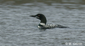 Great Northern Diver - an Annex 1 species
 - Regularly occurring migratory species, such as ducks, geese and waders; and
- Wetlands, especially those of international importance, which attract large numbers of migratory birds each year. (Internationally important means that 1% of the population of a species uses the site - or more than 20,000 birds regularly use the site.)
There are 25 Annex I species regularly occurring in Ireland’s marine
and coastal zone (click
for list). To date, 128 SPAs have been designated. Of these, 82 sites
are on or near the coast. A further five coastal sites are in the process
of designation. Many of the designated and proposed sites hold nationally
or internationally important numbers of waterfowl or seabirds. The predominant
habitats represented at these sites are estuaries, marine islands, lagoons,
sea cliffs, coastal lakes and sand-dunes. Click
here for a list of marine/coastal SPAs on a county by county basis.
Maps of all SPAs can be downloaded from the NPWS
Heritage Data site. Further information on SPAs is available in the
NPWS publication Special Protection Areas for Birds in Ireland.
| |
International (non-EU) Designations
 |
North Bull Island
- Ireland's only Coastal Biosphere Reserve |
| |
Ramsar Sites
There are 22 Ramsar sites - wetlands of international importance – in the Irish coastal zone (out of a national total of 45). Click here for a list of the 22 coastal sites. Ramsar sites are designated by national governments under the Ramsar Convention on Wetlands. The convention requires signatory states to designate wetlands of international importance and to promote their conservation and ‘wise use’. Ramsar sites are designated for their waterfowl populations, important plant and animal
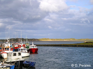 |
| Killala
Harbour, County Mayo - a designated Ramsar Site |
| |
Biogenetic
Reserves
Biogenetic reserves, designated by the Council of Europe following a 1973
European Ministerial Conference on the Environment, are a network of reserves
to conserve representative examples of European flora, fauna and natural
habitats. The network of Biogenetic Reserves promotes conservation through
the maintenance of biological balance and at the same time enabling research
to be carried out on the ecosystems. Of the 14 Biogenetic Reserves in
Ireland, most of which are heathlands, just two are coastal – Lough
Hyne (Co. Cork) and Ballyteigue Burrow (Co. Wexford). Biogenetic Reserves
in Ireland have other protective designations (e.g. Nature Reserves).
HABITATS
 |
| Clare
Island, County Mayo - view from Achill Island |
INTERTIDAL HABITATS
A general description and classification
of intertidal habitat types that occur around the Irish coast can be found
in the Heritage Council publication ‘A Guide to Habitats in Ireland’
(Fossitt,
2000). General descriptions of various intertidal habitats can also
be found on the UK
Biodiversity Action Plan website. More detailed descriptions of intertidal
biotopes (habitats and their communities) can be accessed through the
BioMar CD Viewer or online via the National
Marine Habitat Classification for Britain and Ireland website. The
BioMar Viewer (Picton and Costello, 1998) can be searched geographically
to provide information on specific locations around the coast. Reports
for intertidal surveys carried out along the coasts of Dublin, Wicklow
and Wexford, as part of the SensMap project, can
be downloaded here. Intertidal habitats can be divided into four broad
categories:
 |
Saltmarsh at Barna
house in County Galway |
Saltmarshes
Intertidal Sand and Mudflats
Rocky Shores
Sandy Shores
Saltmarshes
Saltmarshes are intertidal areas of fine sediments stabilised by vegetation.
They occur extensively along the seaward side of low-lying coastal areas,
most notably in sheltered parts of estuaries. The vegetation of saltmarshes
comprises species such as e.g. Salicornia, Spartina
and Puccinellia, which tolerate inundation by salt water. Saltmarshes
are highly productive and a major source of nutrients to estuaries. Five
saltmarsh habitats are listed as Annex I habitats in the EU
Habitats Directive:
- Salicornia and other annuals colonizing mud and sand
- Spartina swards (Spartinion maritimae)
- Atlantic salt meadows (Glauco-Puccinellietalia maritimae)
- Mediterranean salt meadows (Juncetalia maritimi)
- Mediterranean and thermo-Atlantic halophilus scrubs (Sarcocornetea fruticosi)
Curtis and Sheehy-Skeffington (1998) provide a comprehensive inventory
of the salt marshes of the entire coastline of Ireland (click here).
Two-hundred-and-fifty marshes are classified according to physical structure
and origin. All are classified into five main types: estuary, bay, sand
flats, lagoon and fringe. Extensive saltmarshes are found at e.g. Dundalk
Bay (Co. Louth), Bannow Bay (Co. Wexford), Douglas River Estuary (Cork
Harbour) and Tawin Island (Co. Galway). For further information on saltmarshes
see the Heritage Council’s ‘A
Guide to Habitats in Ireland’’ (Fossitt, 2000), online.
See also Curtis (2003).
| |
 |
Designated Sand
and Mudflats on Bellmullet Peninsula in County Mayo |
Although tidal flats may occur in any sheltered area, they are particularly associated with estuaries. Sediments range from soft muds, often in the sheltered inner parts of estuaries, to firm sandflats in outer parts. The fauna varies on different substrate types. Mudflats support a large number and biomass of characteristic estuarine invertebrates; notably crustaceans (e.g. Corophium volutator); gastropod (snails) and bivalve molluscs (e.g. clams and cockles); and polychaete worms (e.g. lugworms and ragworms), on which fish and waterfowl feed. Because of their value to migratory and wintering waterfowl many intertidal flats are internationally important and are designated as Special Protection Areas (SPAs) under the EU Birds Directive. Dundalk Bay, Dublin Bay, Cork Harbour and the Shannon/Fergus estuary are some of the larger examples of this type of habitat. Mudflats and Sandflats not Covered by Seawater at Low Tide are an Annex I habitat under the EU Habitats Directive. Intertidal sand- and mudflats may also occur in two other Annex I habitats – Estuaries and Large Shallow Inlets and Bays. The OSPAR List of Threatened and/or Declining Habitats includes ‘Intertidal mudflats’ and ‘Intertidal Mytilus edulis beds on mixed and sandy sediments’. See the full list and further information here. For further information on intertidal sand and mudflats see the Heritage Council’s ‘A Guide to Habitats in Ireland’ (Fossitt, 2000), online. Information on selected intertidal sand and mudflats around the coast can be accessed through the BioMar viewer.
Rocky Shores
The substrate of rocky shores may consist of bedrock, boulders or cobbles. The distribution of animal and plant species on rocky shores is primarily influenced by the degree of exposure to wave action. Inter-specific competition, aerial exposure and associated desiccation are also important. For example, in the eulittoral zone (between low and high water) the barnacle Chthamalus stellatus and the limpet Patella are characteristic of very exposed conditions. More sheltered shores are characterised by the barnacles Balanus balanoides and Elminius modestus. Rocky shore plant communities are characterised by brown seaweeds (wracks and kelps). Knotted wrack (Ascophyllum nodosum) grows in abundance in areas sheltered from direct wave action. Channel wrack (Pelvetia canaliculata) and spiral wrack (Fucus spiralis) are also indicative of less exposed conditions. Zonation patterns are usually strongly evident on rocky shores, resulting from the varying degrees of exposure by the tide. For example, on the extreme upper shore rocks are typically dominated by lichens, with grey lichens occurring above yellow lichens and a distinctive band of black lichen below these. Brown seaweeds also occur in distinct horizontal bands; e.g. on moderately exposed shores the zonation is from channel wrack and spiral wrack on the upper shore, to bladder wrack (Fucus vesiculosus) in the mid-shore and serrated wrack (Fucus serratus) on the lower shore. Rocky shores are only included within the EU Habitats Directive Annex I habitat type Reefs where they are connected to subtidal reefs.
 |
| Rocky
and Sandy Shore in Killary Harbour, County Galway |
However, they cover much of the intertidal area within the habitat type
Large
Shallow Inlets and Bays. For further information on rocky
shore habitats see the Heritage Council’s ‘A Guide to
Habitats in Ireland’ (Fossitt, 2000), online. Information on selected
rocky shores around the coast can be accessed through the BioMar
Viewer.
Sandy
Shores
The species composition of sandy shore communities is determined by the
sediment composition (ranging from coarse sand and gravel to muddy sands)
and the degree of exposure of the shore to wave action. Exposed areas
with coarse sediment are virtually devoid of all conspicuous flora and
fauna. Mobile, medium-grained sand on exposed beaches support crustaceans
and polychaetes (worms). In less exposed conditions with stable substrata,
sand burrowing bivalves (e.g. Tellina spp. and Donax vittatus)
and polychaete worms (e.g. ragworms and lugworms) become established.
In similar conditions high densities of the sand mason worm (Lanice
conchilega) occasionally occur from mid-shore to the subtidal zone.
The strandline represents a unique ecological niche between the terrestrial
and marine zones. Accumulations of debris (seaweed and litter) provide
a dynamic habitat for flies, beetles, nematode worms and the characteristic
sand-hoppers. Sandy shores commonly occur in the intertidal area of the
the EU Habitats
Directive Annex I habitat type Large
Shallow Inlets and Bays. For further information on sandy
shore habitats see the Heritage Council’s ‘A Guide to
Habitats in Ireland’ (Fossitt, 2000), online. Information on selected
sandy shores around the coast can be accessed through the BioMar
Viewer.
SUBTIDAL HABITATS
 |
Shallow Subtidal
Habitat, County Cork |
A general description and classification of shallow subtidal habitat
types that occur in Irish coastal waters can be found in the Heritage
Council publication ‘A Guide to Habitats in Ireland’ (Fossitt,
2000). General descriptions of various subtidal habitats can also
be found on the UK
Biodiversity Action Plan website. More detailed descriptions of subtidal
biotopes (habitats and their communities) can be accessed through the
BioMar CD Viewer or online via the National Marine
Habitat Classification for Britain and Ireland website.
Boelens et al. (1999) provide a description of the inshore seabed habitats,
and their associated animal and plant communities, on the east, south,
southwest, west and northwest coasts. This review is based on studies
of individual estuaries or bays and the circum-coastal BioMar
survey, covering inshore areas within 5km of the shore and in depths of
less than 50m. The BioMar Viewer (Picton and Costello, 1998) can be searched
geographically to provide information on specific locations around the
coast. Reports for subtidal surveys carried out along the coasts of Dublin,
Wicklow and Wexford, as part of the SensMap project,
can be downloaded here.
As with intertidal habitats, subtidal habitats
and their associated communities can be divided on the basis of the seabed
characteristics. The basic division is between sediment
and rocky habitats. A third, specific
habitat type that occurs in inshore waters is that formed by deposits
of calcareous red algae (Maërl).
Subtidal
Sediment Habitats
The following brief description of subtidal sediment habitats is adapted
from Boelens et al. (1999). Sediment habitats range from shingle (mobile
cobbles and pebbles), through gravel and sand to very soft mud and muddy
gravels. Sediment type is a key factor in determining community structure
and composition. In the upper reaches of estuaries, salinity is also a
controlling variable. With increasing depth, the influence of wave/tidal
action diminishes.
- Soft muddy sediments are characterised by the conspicuous sea pen (Virgularia mirabilis), polychaete worms and anemones; and muddy sands by burrowing brittlestars (Amphiura), urchins, anemones and bivalves. Burrows of the prawn Nephrops norvegicus may also be widespread in the muddy sediments of deeper waters. Beds of seagrass Zostera marina occur on a range of sediments from coarse to muddy sand and the community varies with sediment type.
- Sandy sediments support mainly bivalve and polychaete communities along with burrowing urchins and hermit crabs. In coarse sands there are relatively few species of epifauna (animals living on, or closely associated with, the seabed). The infauna (animals living within the sediment) of coarse sands is dominated by bivalves.
- Gravel communities typically contain gastropods, bryozoans and amphipods. Tide or wave-swept sediments (sand/gravel/shell/cobble) host few species and are characterised by erect hydroids and, on gravel, the sea cucumber (Neopentadactyla mixta).
For further information on subtidal sediment habitats see the Heritage Council’s ‘A Guide to Habitats in Ireland’ (Fossitt, 2000). The BioMar Viewer can be searched geographically to provide information on subtidal sediment habitats at specific locations around the coast. Subtidal Sandbanks are listed in Annex I of the EU Habitats Directive. Subtidal sediment habitats also make up large areas of the Annex I habitat complexes Estuaries and Large Shallow Inlets and Bays. The OSPAR List of Threatened and/or Declining Habitats includes a number of subtidal sediment habitats:
- Zostera beds
- Ostrea edulis (native oyster) beds
- Sea-pen and burrowing megafauna communities
- Sabellaria spinulosa reefs; and
- Modiolus modiolus beds.
See the full list and further information here.
 |
Subtidal rocky habitat
with rocks exposed to air at the Old Head of Kinsale, County Cork |
The following brief description of subtidal rocky habitats is adapted from Boelens et al. (1999). Rocky habitats vary from bedrock to boulders, often mixed with sediment. The degree of stability of the rock determines the communities, with algae and animals increasingly able to colonise smaller stones in more sheltered areas. Exposure to tidal currents and, to a lesser extent, waves has a strong influence on the animal and plant communities of shallow rocky habitats. The shallow water communities on rock around much of the Irish coast are dominated by kelp (Laminariales) forest to about 10-12m depth (upper infralittoral). These range from Alaria esculenta and Laminaria hyperborea at the most wave-exposed coasts with encrusting fauna (bryozoans, sea-squirts, hydroids and sponges) and foliose red algae, to L. hyperborea in less wave-exposed areas with red seaweeds, cushion fauna and grazers (e.g. echinoderms) and L. saccharina in wave-sheltered sites with a rich understorey, often dominated by foliose red algae, with brown and green seaweeds and a mixed estuarine faunal community. Below the kelp forest (depths greater than 10-15m) is a L. hyperborea ‘kelp park’ dominated by echinoderms (urchins, sea-cucumbers and starfish) whose grazing may reduce the presence of encrusting fauna. Anemones, sponges and sea squirts are also common.
Below the kelp park (depths greater than 15-20m) is a mixed community
of red algae, sponges, hydroids, echinoderms and anthozoans. Current-swept
rock and stones are generally dominated by hydroids with the soft coral
Alcyonium digitatum, anemones, seastars and brittlestars also
common. Barnacle, cushion sponge and Tubularia communities also
occur. Beds of the bivalve Musculus discors may occur in current-exposed
parts and contain a rich epifauna of sponges, bryozoans and hydroids.
Wave-exposed areas below about 25m are often sponge dominated. Moderately-sheltered
areas below this depth support mixed faunal turfs, Sabellaria
reefs, brittlestar beds and mussel beds (on rock/mixed substrata). In
the most sheltered rocky areas greater than 25m in depth Modiolus
(horse mussel) beds, brachiopod and sea-squirt communities dominate. For
further information on rocky
subtidal habitats see the Heritage Council’s ‘A Guide
to Habitats in Ireland’ (Fossitt,
2000). The Biomar Viewer can be searched geographically
to provide information on subtidal rocky habitats at specific locations
around the coast. Subtidal rocky areas, or reefs,
are listed as an Annex I habitat in the EU
Habitats Directive. OSPAR list sabellaria and modiolus.
Maërl
Communities
The following brief description of Maërl communities is adapted from
Boelens et al. (1999). Deposits of calcareous red algae (maërl) form
a rare habitat with a rich associated fauna. Seven free-living maërl
species are known to occur in Irish waters. Some species form deep deposits
(maërl beds) that are harvested for agricultural and horticultural
use. These beds occur from the extreme lower intertidal down to the subtidal
zone. The major bed-forming species are thought to be Phymatolithon
calcareum and Lithothamnion corallioides – both of
which are listed in Annex V of the EU Habitats Directive; which states
that their exploitation may be subject to management measures. The faunal
richness of maërl beds has recently been assessed as part of a wider
project studying their distribution and extraction potential (de
Grave et al., 2000). Maërl
beaches, such as that at Coral Strand in Carraroe (Co. Galway), are
formed by the cast-up remains of coralline algae. Maërl beds are
included in the OSPAR
List of Threatened and/or Declining Habitats. See the full list and further
information here.
SELECTED MARINE HABITAT MAPPING PROJECTS
 |
| Glencolumkille,
County Donegal - variety of coastal habitats ranging from sandy
beaches to rocky shores and dunes |
BIOMAR
The BioMar
(Coastal zone management: identification, description and mapping of biotopes)
project was carried out by two Irish (National
Parks and Wildlife Service and Trinity College Dublin), and three
other European partners from 1992 to 1996 and funded by the EU LIFE programme.
It included an extensive survey of marine habitats and their communities
(biotopes) in the intertidal and shallow subtidal (<50m) areas of the
Irish coast. The aims of the project included the development of an inshore
marine biotope classification
system, mapping the location and assessing the relative conservation value
of particular examples of biotopes to assist in the identification of
marine conservation areas. This allowed for the development of criteria
for the selection of marine SACs
under the EU
Habitats Directive and provided an indicative list of potential marine
SACs for Ireland.
The BioMar
Viewer CD consists primarily of a map-linked database of information
on sites, habitats, and species recorded during field surveys (1993 -
1996) of the seashore and seabed in Ireland by the BioMar project and
the Northern Ireland sublittoral survey (1982-1986) by the Ulster
Museum. The information can be searched on a geographical basis by
habitat features, species, biotopes or relevant literature. It also includes:
descriptions and photographs of the BioMar classification
of marine biotopes in Britain and Ireland; descriptions, identification
notes and photographs of marine species; and a large literature database.
Marine
Biotope Classification for Britain and Ireland
A biotope is defined as the combination of an abiotic habitat and its
associated community of species. A marine biotope classification system
has been developed by the Marine
Nature Conservation Review of the Joint
Nature Conservation Committee (UK) – originating as part of
the BioMar Project. The full biotope classification
lists 370 biotopes and sub-biotopes. The classification
website contains a full listing of classification types, a detailed
description of each type, distribution maps and, where possible, colour
photographs. The full biotope classification can be downloaded
or
searched.
 |
Clew Bay, County
Mayo - a designated NHA and SAC |
The National Parks and Wildlife Service funded seabed mapping of five marine Special Areas of Conservation using a single-beam acoustic ground discrimination system (RoxAnn) and several ground-truthing methods (diver surveys, video surveys and grab samples). The five chosen sites (Valentia Harbour/Portmagee Channel, Kilkieran Bay, Roaringwater Bay, Kenmare Bay and Clew Bay) were surveyed in 2001 and 2002. The aim of the work was to produce habitat maps to assist in the development of management plans (a requirement under the EU Habitats Directive) and to aid in future monitoring within the SACs. For further information on these surveys and marine SAC management plans contact the National Parks and Wildlife Service.
SENSMAP
(Sensitivity Mapping of the Coastal Marine Environment in the Southern Irish Sea)
The SensMap project, funded under the European Regional Development Fund - Interreg II programme (1994-1999), was carried out by two Irish partners (National Parks and Wildlife Service and EcoServe) and one Welsh partner (Countryside Council for Wales). Its objectives were:
- To develop an integrated methodology for mapping in the marine intertidal and subtidal, linking both marine and terrestrial maps;
- To develop a protocol for determining the sensitivity of marine biotopes according to the sensitivity of marine species to a range of natural and man-induced changes including, changes to water quality, oil pollution, fishing and recreational activities and climate change;
- To develop a model for a decision making support system based on sensitivity mapping.
The project brought together new data on intertidal and sub-tidal marine
seabed habitats, communities and species along the coasts of Dublin, Wicklow
and Wexford – as well as on the Welsh coast. The data collected,
including biotope maps, is stored electronically and is available to download
on the SensMap
website as a series of reports and as GIS (Geographic Information System)
files. These maps compliment the offshore maps and datasets produced by
the SWISS (South
western Irish Sea Survey) project.
OVERVIEW OF INSHORE MAPPING
As part of a feasibility study on the establishment of a large-scale inshore
resource mapping project, funded under the Marine RTDI fund of the National
Development Plan, Parsons et al. (2004) provide an overview of recent
habitat mapping activity in water depths of 0-50m around the Irish coast.
For more information, click here.
SWISS (South-West
Irish Sea Survey)
HabMAP (HABitat
MAPping for conservation and management of the Southern Irish Sea)
Irish
National Seabed Survey (INSS)
MESH (Development
of a framework for Mapping European Seabed Habitats)
MAMMALS
 |
Bottlenose Dolphin
- Tursiops truncatus |
Mammals occurring in the marine and coastal area include cetaceans, seals and otters (see also Annex II species). Terrestrial mammals are not considered.
CETACEANS
Common Name |
Latin Name |
|
| Porpoises |
Harbour Porpoise |
Phocoena phocoena |
| Dolphins |
Common Dolphin |
Delphinus delphis |
| Striped Dolphin |
Stenella coeruleoalba |
|
| Atlantic White-sided Dolphin |
Lagenorhynchus acutus |
|
| White-beaked Dolphin |
Lagenorhynchus albirostris |
|
| Risso's Dolphin |
Grampus griseus |
|
| Bottlenose Dolphin |
Tursiops truncatus |
|
| Killer Whale |
Orcinus orca |
|
| False Killer Whale |
Pseudorca crassidens |
|
| Pilot Whale |
Globicephala melas |
|
| Beaked Whales |
Cuvier's Beaked Whale |
Ziphius cavirostris |
| Sowerby's Beaked Whale |
Mesoplodon bidens |
|
| Gervais’ Beaked Whale |
Mesoplodon europeus |
|
| True's Beaked Whale |
Mesoplodon mirus |
|
| Northern Bottlenose Whale |
Hyperoodon ampullatus |
|
| Baleen Whales |
Blue Whale |
Balaenoptera musculus |
| Fin Whale |
Balaenoptera physalus |
|
| Sei Whale |
Balaenoptera borealis |
|
| Minke Whale |
Balaenoptera acutorostrata |
|
| Humpback Whale |
Megaptera novaeangliae |
|
| Northern Right Whale |
Eubalaena glacialis |
|
| Narwhal and Beluga |
Beluga |
Delphinapterus leucas |
Sperm Whales |
Pygmy Sperm Whale |
Kogia breviceps |
| Sperm Whale |
Physeter catodon |
 |
Common Dolphin-Delphinus
delphis |
Other species that do not breed in Irish waters migrate annually along the western seaboard and include blue, fin and humpback whales. Some species, such as the beluga, are vagrants on the edge of their range in the Northeast Atlantic and only occur infrequently. The harbour porpoise is the most abundant and widespread of all cetacean species and occurs all around the Irish coast and throughout continental shelf waters. Bottlenose dolphins are also frequently encountered inshore, in bays and estuaries. Ireland has a number of “friendly” bottlenose dolphins that regularly interact with humans. The best known of these is Fungi in Dingle, Co.Kerry. For further information, click here. The Shannon estuary is one of the most important sites for the conservation of cetaceans in Ireland, as it is home to the only known resident group (c.130) of bottlenose dolphins, or any other species of dolphin; and one of only four known resident populations in Europe. It is also an important calving area. For further information on the Shannon dolphins, click here.
Cetaceans in Offshore Waters
In Ireland’s offshore waters areas of significant importance for cetacean abundance and species richness have been identified along the northern/western margins of the Porcupine Shelf and parts of the Porcupine Seabight, off southwestern Ireland (Read more). The shelf edge is a highly productive area with nutrient upwellings leading to high densities of phyto- and zoo-plankton and, thus, fish species. It is an important habitat for resident whales and dolphins but also for migratory species such as blue,
 |
Fin Whale - Balaenoptera
physalus |
fin and humpback whales. These species migrate along the shelf edge,
mainly on the seaward side. The deep water to the west of the continental
shelf provides suitable habitats for deep-diving species such as sperm
whales and beaked whales.
A series of surveys conducted between
1999 and 2001 by the Coastal
and Marine Resources Centre (UCC) recorded twenty cetacean species
in offshore waters. These include rare, endangered and migratory species
of baleen whale (e.g. Northern Right Whale, Blue Whale), and rarely-seen
toothed whale and dolphin species (e.g. Sowerby’s Beaked Whale,
Cuvier’s Beaked Whale, False Killer Whale). Pilot whales and white-sided
dolphins are common on the continental shelf edge, where the water depth
increases rapidly from 200-300m over the continental shelf to 2000-3000m
to the west. For further details on the distribution and abundance of
cetaceans in Ireland’s offshore waters, click here.
Cetacean Strandings
Much of the knowledge on the distribution and relative abundance of cetaceans
comes from records of stranded animals. The recording of cetaceans stranded
on the Irish coast has been carried out since the beginning of the last
century. The Irish Whale
and Dolphin Group (IWDG) have operated a stranding records database
for the island of Ireland since 1991. It is designed to record and make
public biological data on all strandings (live or dead) of whales, dolphins
and porpoise which occur along the Irish coast. The Cetacean Strandings
Scheme works in conjunction with the Department
of Zoology, Ecology and Plant Science in UCC to obtain specimens for
detailed post mortem examination. Further information on the Irish Cetacean
Stranding Scheme can be obtained here.
Stranding records are published annually in the Irish Naturalists’
Journal.
Cetacean Sightings
Information on cetacean distribution is also gathered through sightings
records. Systematic recording of cetacean sightings in Irish waters was
started in 1973. The IWDG
has established two sighting
schemes. The casual sightings scheme enables people who spot a cetacean,
or cetaceans, to report their sighting to IWDG where it is logged onto
a national database. This helps provide information on the number of cetacean
species in Irish waters, their distribution and density. Casual sightings
are good for recording rare species and identifying areas that would benefit
from more intensive coverage. The constant effort sightings involves volunteers
spending fixed periods of time at regular intervals (e.g. weekly) watching
for cetaceans at headlands around the country. It provides an index of
relative abundance, showing seasonal and geographical changes in abundance.
Cetacean
Surveys
 |
| Minke
Whale - Balaenoptera acutorostrata |
| |
The Department of Zoology, Ecology and Plant Science in UCC are the Irish partners in the SCANS-II (Small Cetacean Abundance in the North Sea and Adjacent Waters) project. One of the aims of this project is to determine the absolute abundance of small cetaceans (particularly harbour porpoise, bottlenose dolphin and common dolphin) populations inhabiting shelf waters of the Atlantic margin, the North Sea and adjacent waters, including the Irish Sea and the waters off the west and northwest coasts. The project is a follow-up to the original SCANS project, carried out in 1994, which provided estimates of small cetacean abundance in the Celtic Sea (Hammond et al., 2002).
Legal Protection for Cetaceans
 |
Pilot Whale - Globicephala
melas |
Historically whales were hunted in Ireland but they are now protected under a wide range of national and EU legislation. Cetaceans are protected under the Wildlife Act (1976), which not only protects all cetacean species from hunting but protects their habitat and legislates against “wilful interference”. The Whale Fisheries Act, 1937 (and a subsequent 1982 Statutory Instrument) prohibits the hunting of all cetaceans within the fisheries limits of the State, i.e. out to 200 miles from the coast. All indigenous cetaceans are listed in Annex IV (i.e. species of Community interest in need of strict protection) of the EU Habitats Directive - and the harbour porpoise and bottlenose dolphin are listed in Annex II (i.e. species of Community interest whose conservation requires the designation of Special Areas of Conservation). The Shannon Estuary has been designated as a candidate SAC (Special Area of Conservation) under the EU Habitats Directive due to its bottlenose dolphin population. Two further sites have been designated due to the presence of harbour porpoise - Blasket Islands (Co Kerry) and Roaringwater Bay (Co Cork). Blue, Fin, Sei and Humpback Whales are listed in Appendix I (migratory species considered to be in danger of extinction throughout all or a significant proportion of their range) of the Convention on the Conservation of Migratory Species of Wild Animals (The Bonn Convention). Killer Whales are listed in Appendix II of the convention (migratory species that have an unfavourable conservation status). All five of these species occur in Irish waters. In 1991 the Irish government accepted an IWDG proposal, declaring Ireland (within the exclusive fishery limit) a whale and dolphin sanctuary- the first of its kind in Europe. Finally, Ireland has ratified the International Convention for the Regulation of Whaling - the primary international instrument prohibiting commercial whaling. The National Parks and Wildlife Service is the competent authority responsible for the conservation of cetaceans.
SEALS
 - Phoca vitulina vitulina") |
| Harbour
Seal (Common Seal) - Phoca vitulina vitulina |
Two species of seal breed in Irish waters, the grey seal Halichoerus grypus and the common seal Phoca vitulina (also known as the harbour seal). There are occasional visits by harp (Phoca groenlandica) and hooded (Cystophora cristata) seals and walrus (Odobenus rosmarus rosmarus). For further information on common and grey seals, including population estimates, see the NPWS Irish Wildlife Manuals (Nos. 11 & 13). See also the species information page of the UK Seal Conservation Society (here).
| |
Legal Protection for Seals
The 1976 Wildlife Act affords legal protection to seals. Both the grey
and harbour
seal are listed in Annex
II (i.e. species of Community interest whose conservation requires
the designation of Special Areas of Conservation) of the Habitats
Directive. A number of marine SACs
have been designated due to the presence of grey and common seals, although
they are not the primary reason for site selection.
BIRDS
Ireland’s marine and coastal zone provides important habitats for several groups of birds, and particularly for waterfowl. The most important groups include the ducks (diving ducks and dabbling ducks), geese and swans, waders, and seabirds such as terns and gulls. Many other species are closely associated with the coastal zone. Birds in the marine and coastal zone and their habitats are afforded protection under various international, European and national legislation (read more). This protection is given primarily through the designation of various types of nature reserves: these include Ramsar Sites, Special Protection Areas, Natural Heritage Areas, Nature Reserves, Refuges for Fauna and Wildfowl Sanctuaries. The importance of the marine and coastal zone for birds is highlighted by the fact that:
- Eighty-two of the 128 Special Protection Areas designated under the EU Birds Directive are in the marine and coastal zone.
- Ninety-two out of the 140 Important Bird Areas in Ireland are in the marine and coastal zone.
- Fourteen waterfowl and 11 seabird species that occur regularly in the coastal zone are listed in Annex I of the EU Birds Directive. A further seven other Annex I species also breed and/or occur regularly.
- The marine and coastal zone hosts 30 of the 32 species in Ireland that are considered to have unfavourable conservation status.
 |
Canadian Geese -
Branta canadensis |
WATERFOWL
Due to its position on the East Atlantic Flyway (a migration route used
by birds breeding around the Arctic Circle and wintering in Europe and
Africa) Ireland is a major wintering and migration area for waterfowl
- which include wildfowl (ducks, geese and swans) and waders (including
plovers, sandpipers, curlews, godwits and others). Birds from breeding
grounds in NE Canada, Greenland, Iceland and northern Europe arrive during
autumn in their hundreds of thousands and depart again in spring. Many
species that do not stay for the full winter - paricularly waders - feed
and rest for short periods in autumn en route to wintering grounds in
southern Europe and Africa and on their return journey in spring. Approximately
60
species of waterfowl are attracted to the great variety and number
of wetland habitats on the coast (including estuaries and bays, coastal
lagoons, polders / sloblands and open shores and shallow seas). These
provide an abundance of food (including fish, invertebrates, sea-grass,
algae and grasses) and safe breeding sites and roosting areas.
The
Irish Wetland Bird Survey
The Irish Wetland Bird Survey (I-WeBS)
is the principle tool for monitoring wintering waterfowl populations and
their wetland habitats in Ireland. The survey, a joint scheme run by BirdWatch
Ireland, the National
Parks & Wildlife Service of the Department of the Environment,
Heritage and Local Government in the Irish Republic and the Wildfowl
and Wetlands Trust in Northern Ireland, started in 1994 and comprises
monthly co-ordinated site counts by over 320 professionals and amateurs
over the September to April season. Approximately 320 wetland sites and
800 subsites are monitored each season, comprising both inland (lake /
turlough / river systems) and coastal (estuaries /bays / lagoons / coastal
stretches) sites. The project aims to be the primary source of data for
the conservation of waterfowl populations and the wetland habitats on
which they depend. A large volume of data is collected annually from a
variety of wetland sites throughout Ireland. The information is used to
describe and assess population trends, assess importance of individual
wetland sites and hence take appropriate conservation measures. Annual
count data are published by BirdWatch Ireland. Bird count data from a
number of coastal sites surveyed as part of I-WeBS are being used in climate
impact models as part of the MONARCH
project.
 |
| Birds
utilizing the mudflats in Cork Harbour |
Important Coastal Waterfowl Sites
Many of the most important wetland sites in Ireland are coastal and primarily intertidal, including nine of the top twelve waterfowl sites in the Republic of Ireland (average annual maximum greater than 20,000 birds – a qualifying criteria for designation as a Ramsar site). They are:
- Shannon & Fergus Estuary (Co. Clare)
- Dundalk Bay (Co. Louth)
- Wexford Harbour & Slobs
- Cork Harbour
- Dublin Bay
- Tralee Bay, Lough Gill & Akeragh Lough (Co. Kerry)
- Lough Swilly (Co. Donegal)
- Ballymacoda (Co. Cork)
- Tacumshin Lake (Co. Wexford)
A further 12 coastal sites regularly hold more than 10,000 birds (out
a national total of 15 sites with 10-20,000 birds) (click here).
Many of the important waterfowl sites on the coast are designated as SPAs
under the EU Birds
Directive.
Important Waterfowl Species
Absolute numbers of waterfowl is not the only indicator of the importance
of a wetland site. The occurrence of a particular species, or a number
of a particular species, can also be an important factor. For example,
the race of White-fronted Goose that winters in Ireland breeds in Greenland
and winters almost exclusively in Ireland, Scotland and Wales. Wexford
Harbour and Slobs host significant numbers of the world population of
this species. The Light-bellied Brent Goose, which breeds in the Canadian
Arctic, is internationally recognised as a separate population and winters
almost exclusively in Ireland. Strangford Lough holds over 50% of the
world population of light-bellied brent goose in the early winter, before
the birds disperse to sites mainly on the east and south-east coasts.
Many sites contain a relatively small total waterfowl population but are
nevertheless classified as internationally or nationally important because
they regularly hold 1% or more of the individuals in the international
or national population of one or more species or subspecies. For example,
Trawbreaga Bay (Co. Donegal) hosts approximately 2,500 waterfowl but hosts
internationally important numbers of Light-bellied Brent Goose and Barnacle
Goose. Thirteen species of waterfowl occur at one or more coastal sites
in internationally important numbers (see list).
Eighteen waterfowl species that regularly occur in coastal wetland sites
have an unfavourable conservation
status in Europe. Click here
for a list of species. Altogether, 32 coastal sites host internationally
important numbers of one or more species of waterfowl. A further 38 coastal
sites host nationally important numbers of one or more species of waterfowl.
For a full list of important coastal wetland sites on a county by county
basis, click here.
Many additional coastal sites are regionally or locally important. A full
list of sites surveyed by I-WeBS and their waterfowl numbers can be obtained
from BirdWatch
Ireland.
 |
Black Headed and
Common Gulls in Rinvyle SAC, County Galway |
SEABIRDS
Conditions around the Irish coast meet the two main requirements of breeding
seabirds, namely a safe, suitable habitat in which to nest and a supply
of food within foraging range of breeding colonies. Breeding seabirds
use islands, headlands and sand/shingle beaches on which to form their
nesting colonies and exploit fish and other marine organisms for food.
Approximately 30 species of seabirds occur regularly on Ireland’s
coast (See list).
Many of these breed on the coast. Read more on each species here.
Some species (all terns, storm petrel and manx shearwater) migrate outside
the area after completion of breeding, whilst others remain throughout
the year. Other species are true winter visitors or passage migrants,
wintering in or using the area as a migratory corridor in spring, autumn
and winter (e.g. skuas and shearwaters). A number of seabird species are
of conservation concern.
Seabird Numbers and Important Sites
BirdWatch Ireland
was the Republic of Ireland co-ordinator of Seabird
2000, a major Irish-British survey of seabird colonies that took place
between 1999 and 2001. It was a follow-up to two other near complete surveys
of Irish seabirds: Operation Seafarer (1969-70) and the Seabird Colony
Register (1985-87). During the course of the survey, which was carried
out by a dedicated group of BirdWatch Ireland volunteers, professional
ornithologists and NPWS
staff, counts of all seabird species at the majority of colonies in the
country were carried out. These included not only the big cliff sites
such as the Cliffs of Moher (Co. Clare) and Horn Head (Co. Donegal) but
also the large numbers of gulls nesting on islands in lakes and on rooftops
in cities, and nocturnal petrels and shearwaters that live in burrows
on the remotest islands off the west coast. The results of Seabird 2000
are published as “Seabird Populations of Britain and Ireland”,
(T & AD Poyser Ltd, 2004) and are also available, in limited format,
(Tables, Maps and Figures) on a species by species basis on the JNCC
(Joint Nature Conservation Committee) website, here.
A customised database has been created to host the data collected during
Seabird 2000. Detailed information can be obtained electronically here.
Unlike those for wintering waterfowl, the criteria for designation of seabird breeding sites are not as well defined. However, it is possible to identify the most important seabird breeding sites on the Irish coast based on the presence of one or more species in numbers greater than, for example, 1% of the EU or UK and Irish populations. Some of the more important colonies from an individual species point of view are:
-
Inishtooskert (Co. Kerry) – This Storm Petrel colony, with approximately 27,000 nests, is the largest in Ireland and Britain, and possibly the world. Storm Petrel - Pelagodroma marina
 - Little Skellig (Co. Kerry), a BirdWatch Ireland Nature Reserve, holds the largest Gannetry in Ireland (approx. 25,000 pairs).
- The Stags of Broadhaven (Co. Mayo) is Ireland’s only Leach’s Petrel colony.
- Rockabill Island (Co. Dublin) is the largest Roseate Terns colony in Europe, and with approximately 600 pairs holds a significant proportion of the European population. The Roseate Tern is classified as a threatened red-list species (Read More). Other important tern sites include Kilcoole (Co. Wexford) and Lady’s Island Lake (Co. Wexford). Read more about BirdWatch Ireland’s Tern Conservation Projects.
Other seabird breeding colonies with significant populations of one or
more species include:
| Site | County | Important Species |
| Lambay Island | Dublin | Cormorant, Guillemot, Shag |
| Ireland’s Eye | Dublin | Cormorant |
| Little Saltee | Wexford | Cormorant |
| Great Saltee | Wexford | Guillemot, Razorbill |
| Keeragh Islands | Wexford | Cormorant |
| Sovereign Islands | Cork | Cormorant |
| Scarriff Island | Kerry | Storm Petrel |
| Great Skellig | Kerry | Storm Petrel |
| Puffin Island | Kerry | Storm Petrel |
| Inishvickillane | Kerry | Storm Petrel |
| Inishnabro | Kerry | Storm Petrel |
| Inishtearaght | Kerry | Storm Petrel |
| Cliffs of Moher | Clare | Guillemot, Razorbill |
| Deer Island | Galway | Cormorant |
| Inishark | Galway | Storm Petrel |
| Duvillaun Islands | Mayo | Cormorant |
| Inishglora | Mayo | Storm Petre |
| Illaunmaster | Mayo | Storm Petre |
| Ardboline | Sligo | Cormorant |
| Horn Head | Donegal | Razorbill |
| Inishtrahul | Donegal | Shag |
Sites may not hold internationally important numbers of individual species,
but regularly hold large total populations are also important. Many of
the important seabird breeding colonies on the coast are designated as
SPAs under the EU
Birds Directive. For a full list of SPAs with breeding seabird colonies,
click here.
See also the Irish Important Bird Area (IBA) list. Under the Wildlife
Act, 1976 seven Refuges for Fauna have been designated on cliffs and islands
to protect breeding seabird populations (Link to List). Nine seabird species
that regularly breed and/or occur at coastal sites have an unfavourable
conservation status in Europe. Click here
for a list of species.
 |
Gannet |
Offshore Seabirds
Ireland’s offshore waters are essential feeding grounds for many
birds, including non-breeders and passage migrants, throughout the year.
Over fifty species of seabirds have been recorded in irish waters, both
on and off the shelf (Pollock et al., 1997).
Food for seabirds is not evenly distributed over the shelf waters around
Ireland. Many invertebrates and fish are concentrated at spawning or feeding
grounds and at distinct boundaries where water masses meet and which are
typified by increased productivity. The Irish Sea hosts major feeding
concentrations, particularly guillemots and razorbills, in the period
mid-July to mid-September. Rich feeding grounds occur north-east of county
Louth (around the mixing zone of the western Irish Sea front) and along
the sandbanks and gravel ridges that run parallel to the coasts of Wicklow
and Wexford. The productive waters off the south-west coast also provide
an ample food supply for large breeding colonies on the south-west coast.
Boelens et al. (1999) provide a concise summary
of the distribution of offshore seabirds.
A series of surveys conducted between 1999 and 2001 under the Petroleum
Infrastructure Programme of the Department
of Communications, Marine and Natural Resources, and carried out by
the Marine
Mammals and Seabirds Group (Coastal and Marine Resources Centre, UCC)
gathered information on the abundance of seabirds in the waters of Ireland’s
Atlantic Margin and identified areas of importance for seabirds (Mackey
et al., 2004). Download here.
The surveys recorded 37 seabird species, including important, rarely-sighted
species such as Brünnich’s Guillemot and Soft-plumaged Petrel,
and key migratory species, such as the Black-legged Kittiwake, Northern
Gannet and the Lesser Black-backed Gull.
Areas of relatively high species richness and high density for seabird
species were identified in the deeper Atlantic waters off the southwest,
west and northwest coasts of Ireland. The Hatton Bank and Hatton-Rockall
Basin also appear to be of importance to migratory species, and together
with the Rockall Bank may be of importance to those species that winter
offshore, such as the Atlantic Puffin, and to non-breeding and juvenile
birds during the breeding season (e.g. Manx Shearwater). Records of seabirds
at sea in Irish waters are maintained by the JNCC
Seabirds at Sea Team in the European Seabirds at Sea database.
OTHER
BIRDS
In addition to seabirds and waterfowl a large number of other birds regularly
occur in coastal areas. Many of these are not exclusive to the coastal
zone. However, for some such as the corncrake
and chough, both of which are considered to be
of conservation concern, the coastal zone provides vital habitats.
Corncrake
The Corncrake is the only Irish breeding bird which is threatened with
global extinction. It is an Annex I species under the EU
Birds Directive and is listed by BirdLife
International as being of global conservation
concern. Corncrakes were once common in Ireland. An All-Ireland census
carried out in 1988 found that the population had dropped to just over
900 singing males, and to 129 by 1994. Corncrakes are now restricted to
three core areas in Ireland - the Shannon Callows, North Donegal and West
Connaught Co Mayo. In the latter two areas the corncrake sites are principally
coastal sites and include Tory Island, Inishbofin, Falcarragh / Min an
Chladaigh, and Malin and Fanad Peninsulas (Co. Donegal); Clare Island
and Mullet Peninsula (Co. Mayo); and Inishbofin and Omey Island (Co. Galway).
BirdWatch Ireland
has operated an intensive Corncrake
Conservation Project in Ireland since 1991, with the support of the
Department of Environment,
Heritage and Local Government and the Royal
Society for the Protection of Birds (RSPB). As a result of concentrated
conservation measures, however, numbers rose for the first time in 1995
and over the last six or seven years corncrake numbers in West Donegal
and, to a lesser extent, west Connaught have increased. In 2004, 29 out
of the 142 calling males recorded nationally were on Tory Island (Co.
Donegal), confirming the island’s status as Ireland’s single
most important site for Corncrakes. For further information on corncrakes
and the BirdWatch Ireland Corncrake Conservation Project, click here.
Chough
The Chough is a scarce member of the crow family, confined mostly to the
northern and western coasts of Ireland. Breeding takes place mainly in
holes and crevices of coastal cliffs. It is classified as a Red-Listed
species in the Birds
of Conservation Concern in Ireland (BoCCI) List and recognised as
a declining species. They are also listed in Annex I of the EU
Birds Directive. A Chough Survey of Ireland was carried out in 2002-2003.
The key hotspot for Chough population in Ireland is the Dingle peninsula
(Co. Kerry). Other important mainland chough breeding areas include the
west Donegal coast, Iveragh peninsula (Co. Kerry), Beara Peninsula (Co.
Cork) and Sheeps’ Head and Mizen Head peninsulas (Co. Cork). Offshore
islands (e.g. Cape Clear, Great Blasket, Aran and Bear Islands) are also
important chough breeding locations. For further information on choughs
and the national chough survey, click here.
 |
Group of Birds over
the Sea |
(IBAS)
Important Bird Areas are sites particularly important for bird conservation because they regularly hold significant population of one or more globally or regionally (e.g. on a european or European Union level) threatened, endemic or congregatory bird species or highly representative bird asembladges. The European Important Bird Areas (IBAs) Programme – one of the regional IBA programmes administered through Birdlife International - aims to identify, monitor and protect key sites for birds all over the continent. Important Bird Areas, selected on the basis of internationally agreed standard criteria, aim to form a network of sites ensuring that migratory species find suitable breeding, stop-over and wintering places along their respective flyways. In Europe, the selection criteria take into account the requirements of regional conservation treaties such as the EU Birds Directive. In Ireland the Birdlife partner is BirdWatch Ireland.
The European Important Bird Area Programme aims to identify, monitor and protect key sites for birds all over the continent through joint efforts of staff and volunteers at local, national and international level. Important Bird Area inventories have been published since 1981. The second Pan-European IBA inventory was published in 2000 and listed 140 IBAs in Ireand. Of these, 92 are in the marine and coastal zone. These are further categorised into sites of Global (33 sites), European (44 sites) and European Union (15 sites) importance. For a full list of IBAs on a county by county basis click here. Irish IBA site descriptions can be viewed on the BirdLife International website here or in the Irish section of the 2000 IBA list here.
| |
The IBA network is not static. Sites can be added or removed. For instance, the next inventory will include a suite of marine IBAs. In Ireland, the information collected as part of the Seabird 2000 survey and a recent chough survey will undoubtedly assist in updating the IBAL list. New wetland sites may also be added based on results from I-WeBS. IBAs have no formal legal standing. However, BirdLife International aims to get all IBAs protected under national and/or international law in order to ensure their adequate legal safeguard. The National Parks and Wildlife Service follow up on the Irish IBA list, and try to ensure all are included in the SPA, or at least the NHA, network. For further information on IBAs, selection criteria and data collection methods, click here.
CONSERVATION STATUS OF BIRDS IN THE MARINE AND COASTAL ZONE
 |
| Little
Egret - Egretta garzetta, a species on the Amber list |
- Red List - High Conservation Concern
- Amber List - Medium Conservation Concern
- Green List - regularly occurring species in Ireland whose conservation status is presently considered favourable.
Click here
for Red List seabird and waterfowl species in the marine and coastal zone.
Click here
for Amber List seabird and waterfowl species in the marine and coastal
zone.
For further information and a full list of species click here.
Red Data Book Species
The Irish Red Data Book 2: Vertebrates (Whilde,
1993) provides a review of rare and threatened mammals, birds, amphibians
and fish in Ireland using criteria laid down by IUCN
(The World Conservation Union). Species on the IUCN
Red List are categorised as Extinct, Endangered, Vulnerable, Rare,
Indeterminate or Internationally Important. The criteria for classification
are described in detail here.
Included in the Red Book are a number of seabirds and waterfowl that occur
in marine and coastal areas. In the period since publication of the Irish
Red Data Book, a considerable amount of new information has been gathered
on the status, trends and distribution of Irish birds, and new criteria
for establishing the conservation status of national populations have
been developed. In 2000, BirdWatch Ireland published a report titled Birds
of Conservation Concern in Ireland. This is the result of a cross-border
initiative between BirdWatch Ireland and the Royal Society for the Protection
of Birds (in Northern Ireland).
Rare Birds
The Irish
Rare Birds Committee (IRBC) is responsible for maintaining a list
of the birds recorded in the Republic of Ireland. Its primary function
is the assessment of records of certain rare and scarce species. Results
are published annually in the Irish Bird Report and IRBC Report. The Committee
operates under the auspices of BirdWatch
Ireland.
FISH
 |
| Angling
Sign on the Beara Peninsula, County Cork |
N.B. The following account of inshore fish assemblages is taken from Boelens et al. (1999).
In inshore waters, fish habitats can be divided into hard and soft sediments. The sandy areas are typified by large numbers of juvenile flatfish (plaice, sole etc.) and sand-eels, with seasonal influxes of sprat, herring, juvenile gadoids, mullet and bass. Rocky shore fish assemblages are diverse and dominated by small species such as wrasses, gobies and blennies, as well as juvenile pollack and saithe. Rocky intertidal areas also support gobies and blennies adapted to surviving periods of low oxygen levels and elevated temperatures. Estuaries attract many species of fish including mullet, bass, sprats, juvenile herring and flounders.
The distribution of fish is far from uniform,
even in areas of apparently uniform sediment type. Topographical features
such as rocky outcrops, coral patches, gulleys and wrecks provide food
and shelter from tidal streams and often support high densities of species
such as pollack, saithe, ling, conger eels and cod, with large flatfish
such as turbot attracted to the surrounding sandy areas. Some species
such as sole are highly specialised in terms of morphology and diet and
are restricted to areas of soft sediments whereas species such as cod
are more generalised with a broad diet and equally broad distribution.
A list of 375 fish species recorded in Irish waters, along with species
information, can be accessed through FishBase.
Species of Conservation Concern
In addition to the commercial fish species and other commonly occurring
fish species around the coast, a number of species are uncommon and/or
are considered to be of conservation concern. SACs
have been designated in coastal waters for four fish species listed under
Annex II of the
EU Habitats Directive – Allis
Shad, Twaite
Shad, Sea
Lamprey and River
Lamprey. Other species that are of conservation concern, but which
are not included in the Habitats Directive, include:
The Red List, compiled by the IUCN (The World Conservation Union) categorises species according to their conservation status (e.g. Extinct, Endangered, Vulnerable, Lower Risk). The criteria for classification are described in detail here. Included in the Red List are a number of fish species that occur in Irish waters, including Angel Shark (vulnerable), Basking Shark (vulnerable) and Haddock (vulnerable). A full list of Irish Red List species is available here. The Irish Naturalists’ Journal publishes records of rare/unusual fish taken in both inshore and offshore waters. Finally, the OSPAR List of Threatened and/or Declining Species includes a number of fish species that occur in Irish waters. See list.
SELECTED FISH SPECIES OF CONSERVATION CONCERN
The Smelt lives in estuaries and migrates into large clean rivers to breed just above the estuarine limit. It is listed in the Irish Red Data Book as vulnerable and has been recorded in only a few locations around Ireland – Shannon Estuary, Foyle Estuary, River Suir, River Barrow and Blackwater Estuary (Co. Cork). There is currently no legal protection for smelt. For further information on smelt in Irish waters, click here.
Couch’s Goby (Gobius couchi)
Couch’s Goby is found in lower intertidal and inshore waters, under stones or algae on sheltered muddy sand. It has only been recorded from two locations in Ireland - Lough Hyne (Co. Cork) and Mulroy Bay (Co. Donegal). Click here, for further information.
Red-mouthed Goby (Gobius cruentatus)
The Red-mouthed Goby is found inshore, on rocks, sand and sea-grass meadows. It has been recorded in just three locations, all in Co. Cork - Cleanderry Harbour (Kenmare River), Lough Hyne and Bantry Bay.
Basking Shark (Cetorhinus maximus)
The basking shark is the second largest fish in the world (the largest being the whale shark) and by far the largest fish that occurs in the waters around Britain and Ireland. It reaches lengths of up to 10m and normally swims along close to the surface with its first dorsal fin, snout and tail fin breaking the surface. It feeds by filtering huge quantities of seawater through its gills and trapping planktonic organisms on its gill rakers. Basking sharks occur around the entire Irish coast. The majority of sightings of basking sharks are in the summer months and mainly on days when the sea is calm enough to distinguish the large fins and snout breaking the surface. The basking shark is listed as Vulnerable in the IUCN Red List, and is included in the OSPAR list of threatened or declining species and in Appendix II of the Convention on International Trade in Endangered Species (CITES). For further information on Basking Sharks, click here or here.
Short-snouted Seahorse (Hippocampus hippocampus)
The short-snouted seahorse is one of two species of seahorses found in Irish waters; the other is the long-snouted seahorse. The short-snouted seahorse is found in shallow muddy waters, in estuaries or inshore amongst seaweed and seagrasses, clinging by the tail or swimming upright. Hippocampus hippocampus can also be found in rocky areas. Seahorses of Hippocampus spp. are globally exploited for use as medicines, aquarium fishes, curios and even foods. There is little information available on the distribution of the short-snouted seahorse in Irish coastal waters. However, it is known to occur along the south and west coasts. The short-snouted seahorse is included in the OSPAR list of threatened or declining species; the Bern Convention; the IUCN Red List of Threatened
 |
Seahorse |
Species, and the Convention
on International Trade in Endangered Species (CITES). For further
information on the biology, distribution, sensitivity, etc. of the short-snouted
seahorse, click here. See also the website of the
Seahorse Trust and Seahorse
Ireland.
Long-snouted Seahorse
(Hippocampus guttulatus)
Like the short-snouted seahorse, the long-snouted
seahorse is found in shallow waters, especially amongst algae and sea
grasses, clinging by the tail or swimming upright. Also like the short-snouted
seahorse there is little information available on the distribution of
the short-snouted seahorse in Irish coastal waters. However, it is known
to occur along the south and west coasts. The long-snouted seahorse is
listed as Vulnerable in the IUCN Red List; and is included
in the OSPAR
list of threatened or declining species; the Bern Convention; and the
Convention on International Trade in Endangered Species (CITES). For further
information on the biology, distribution, sensitivity etc. of the long-snouted
seahorse, click here.
See also the website of the Seahorse
Trust and Seahorse
Ireland.
URLs in text
Heritage Council Study
- http://heritagecouncil.ie/publications/coastalrep/
NPWS Heritage Data
- www.heritagedata.ie
IGH Programme - http://www.gsi.ie/workgsi/heritage/heritage-frame.htm
Tetrapod Trackway - http://www.gsi.ie/workgsi/heritage/igh/sites/valentia/track.htm
Details of Nature Reserves
- http://82.112.120.223/en/NatureConservation/NatureReserves/
Biosphere Reserves
- http://www.unesco.org/mab/wnbr.htm
UNESCO - http://www.unesco.org/
MAB
Programme - http://www.unesco.org/mab/
Strategic Framework
- http://www.ramsar.org/key_guide_list_e.htm#v
MIDA - the Marine Irish Digital Atlas - http://mida.ucc.ie
Habitats
Northern Ireland
Habitat Action Plans (HAPs) http://www.ehsni.gov.uk/natural/biodiversity/hap_ni.shtml#mar05
Northern Ireland
Species Action Plans (HAPs) http://www.ehsni.gov.uk/natural/biodiversity/sap_ni.shtml
The European Register
of Marine Species - http://www.marbef.org/data/erms.php
Encyclopedia of Marine
Life of Britain and
Sherkin Island Review
(HC Website) http://www.heritagecouncil.ie/marine/review1.html
HC Audit of Marine
Datasets - http://www.heritagecouncil.ie/audit/inverts.html
MARLIN - The Marine
Life Information Network for
NPWS Marine Wildlife
Inventory - http://www.npws.ie/en/PublicationsLiterature/Allpublications/file,834,en.pdf
Fossitt - http://www.heritagecouncil.ie/publications/habitats/11.html
National
Marine Habitat Classification for
SensMap Reports - http://www.ecoserve.ie/projects/sensmap/reports.html
Curtis
and Sheehy-Skeffington - http://www.ria.ie/publications/journals/procbi/1998/PB98I2/PDF/98208BI.pdf
HC Saltmarshes - http://www.heritagecouncil.ie/publications/habitats/11.html
HC
Intertidal Sand- and Mudflats - http://www.heritagecouncil.ie/publications/habitats/12.html
HC
Rocky Shores - http://www.heritagecouncil.ie/publications/habitats/12.html
HC
Sandy Shores - http://www.heritagecouncil.ie/publications/habitats/12.html
Fossitt - http://www.heritagecouncil.ie/publications/habitats/11.html
National Marine Habitat Classification for
SensMap Reports - http://www.ecoserve.ie/projects/sensmap/reports.html
HC
Marine Subtidal Sediment Habitats- http://www.heritagecouncil.ie/publications/habitats/13.html
HC
Marine Subtidal Rocky Habitats- http://www.heritagecouncil.ie/publications/habitats/13.html
De Grave et al. (2000) - http://www.marine.ie/information+services/library+services/marine+institute+publications
/marine+resource+series/r10.pdf
Maerl Beaches - http://seaweed.ucg.ie/descriptions/maerl.html
BioMar - http://www.ecoserve.ie/biomar/index.html
BioMar
Viewer - http://www.ecoserve.ie/biomar/viewer.html
MNCR - http://www.jncc.gov.uk/page-1596
JNCC - www.jncc.gov.uk
Marine Habitat Classification
for
Download Marine Habitat Classification - http://www.jncc.gov.uk/page-1645
Search Biotopes - http://www.jncc.gov.uk/marine/biotopes/BiotopeSearch.aspx
MARBEF
- http://www.marbef.org/
SensMap - http://www.ecoserve.ie/projects/sensmap/
EcoServe - http://www.ecoserve.ie/
CCW - http://www.ccw.gov.uk/
Inshore resource mapping project,
Parsons et al. - http://www.marine.ie/funding/marine+institute+funding/marine+rtdi+fund
/desk+studies/index.htm
IWDG
- http://www.iwdg.ie
IWDG
Species Profiles - http://www.iwdg.ie/species_profiles.asp
Seawatch
Foundation - http://www.seawatchfoundation.org.uk
Seawatch
Foundation Species Guide - http://www.seawatchfoundation.org.uk/species-main.htm
Ireland's
'friendly' wild dolphins - Irishdolphins.com
Shannon
Dolphins - http://www.shannondolphins.ie/
Cetaceans
Offshore - http://cmrc.ucc.ie/pages/projects/cetacea.htm
CMRC
- http://cmrc.ucc.ie/
Department of Zoology, Ecology and Plant Science
UCC - http://www.ucc.ie/academic/zeps/
IWDG
Cetacean Strandings Scheme - http://www.iwdg.ie/strandings.asp?cat=3
IWDG
Cetacean Sightings Scheme - http://www.iwdg.ie/iscope/?cat=2
Petroleum
Infrastructure Programme - http://www.pip.ie/page/1
Marine
Mammals and Seabird Group (CMRC) - http://cmrc.ucc.ie/pages/res_marinemands.htm
ōCetaceans
and Seabirds of Ireland's Atlantic Marginö http://cmrc.ucc.ie/pages/projects/cetacea.htm
SCANS II - http://biology.st-andrews.ac.uk/scans2/index.html
NPWS Wildlife Manuals - http://www.npws.ie/en/PublicationsLiterature/IrishWildlifeManuals/
UK Seal Conservation Society - http://www.pinnipeds.org/species/species.htm
I-WeBS - http://www.birdwatchireland.ie/bwi/pages092003/consvwork/surveys/iwebs.html
Birdwatch
Wildfowl and Wetlands Trust - http://www.wwt.org.uk/
Seabird Species Descriptions - http://www.jncc.gov.uk/page-3201
Seabird 2000 Website - http://www.jncc.gov.uk/page-1548
JNCC - www.jncc.gov.uk
Seabird 2000 Data - http://www.jncc.gov.uk/page-2919
BirdWatch Tern Projects - http://www.birdwatchireland.ie/bwi/pages092003/consvwork/projects/terns.html
Petroleum Infrastructure Programme - http://www.pip.ie/page/1
Marine Mammals and Seabird Group CMRC - http://cmrc.ucc.ie/pages/res_marinemands.htm
Atlantic Margin Study - http://cmrc.ucc.ie/pages/projects/cetacea.htm
JNCC Seabirds at Sea Team - http://www.jncc.gov.uk/page-1547
BirdLife International - http://www.birdlife.net/
BirdWatch Corncrake Project - http://www.birdwatchireland.ie/bwi/pages092003/consvwork/projects/corncrakes.html
RSPB - http://www.rspb.org.uk/
Species Conservation Plan - http://www.npws.ie/en/PublicationsLiterature/PublicConsultationforAll-IrelandSpeciesAction/
Environment and Heritage Service - http://www.ehsni.gov.uk/
Chough Survey - http://www.birdwatchireland.ie/bwi/pages092003/consvwork/surveys/chough.html
European IBAs - http://www.birdlife.net/action/science/sites/european_ibas/index.html
Irish IBA Site Search - http://www.birdlife.net/datazone/sites/index.html
Species Conservation Information - http://www.birdlife.net/action/science/species/birds_in_europe/species_search.html
BoCCI - http://www.birdwatchireland.ie/bwi/pages092003/consvwork/policies/bocci.html
IUCN - http://www.iucn.org
Red List - http://www.redlist.org/
Red List Criteria - http://www.redlist.org/info/categories_criteria.html
Irish Rare Birds Committee - http://www.birdwatchireland.ie/bwi/irbc/irbc.html
2004 Stock Book - http://www.marine.ie/industry+services/fisheries/the+stock+book/
ICES ADVICE
- http://www.ices.dk/
FishBase -
http://www.fishbase.org/home.htm
Red List -
http://www.redlist.org/
IUCN - http://www.iucn.org
Red List Criteria
- http://www.redlist.org/info/categories_criteria.html
Search Irish
Red List Species - http://www.redlist.org/search/search-basic.html
Irish Naturalists'
Journal - http://www.habitas.org.uk/inj/
Smelt - http://www.ria.ie/publications/journals/procbi/2004/Pb104i3/PB104I3.html
Couch's Goby - http://www.marlin.ac.uk
Basking
Shark - http://www.marlin.ac.uk/species/Cetorhinusmaximus.htm
Short-snouted Seahorse - http://www.marlin.ac.uk/species/Hippocampushippocampus.htm
Seahorse Trust - http://www.theseahorsetrust.co.uk/
Seahorse
Long-snouted Seahorse - http://www.marlin.ac.uk/species/Hippocampusguttulatus.htm
Habitats
Benthos Research Group, 1992.
Boelens, R.G.V., Walsh, A.R., Parsons, A.P. and Maloney, D.M.
(1999). Ireland's Marine and Coastal Areas and Adjacent Seas: an Environmental
Review. Marine Institute,
Dineen, P., Keegan, B.F., Crowe, W.A., O'Connor, B., McGrath,
D., Costelloe, M. and K÷nnecker, G., (1986).Littoral and benthic investigations on the south
coast of
Healy, B. and McGrath, D. (1998).Marine fauna of
Keegan, B., O'Connor, B., McGrath, D., K÷nnecker, G., and
O'Foighil, D., (1987). Littoral
and benthic investigations on the south coast of
Kelly, K.S., Costello, M.J., Baxter, P.W. and Picton, B.E.
(1997). An indexed bibliography
of Irish marine literature from 1893-1997.Ā
Environmental Sciences Unit,
O'Connor, B., McGrath. D., K÷nnecker, G. and Keegan, B.F.,
(1993). Benthic macrofaunal assemblages
of greater
Roche, C., Clarke, S. & O'Connor, B. (2005).Inventory of Irish marine wildlife publications.Ā
Irish Wildlife Manuals,
No. 16. National Parks and Wildlife Service,
Department of Environment, Heritage and Local Government,
Shin, P.K.S.,
Habitats
Boelens,
R.G.V., Walsh, A.R., Parsons, A.P. and Maloney, D.M. (1999).Ireland's
Marine and Coastal Areas and Adjacent Seas: an Environmental Review.Marine Institute,
Challinor,
H., Murphy Wickens, S., Clark, J. and Murphy, A. (1999).A Beginner's Guide to
Connor,
D.W.,
Curtis,
T.G.F. (2003). Saltmarshes.In: Otte, M.L. (ed.)Wetlands
of
Curtis, T.G.F. and Sheehy Skeffington, M. (1998).Ā
The Salt Marshes of Ireland: An inventory and account of their
geographical variation.Biology
and Environment: Proc. R. Ir. Acad., 98B (2): 87-104.http://www.ria.ie/publications/journals/procbi/1998/PB98I2/PDF/98208BI.pdf
De
Grave, S., Fazakerley, H., Kelly, L., Guiry, M.D., Ryan, M. and Walshe,
J., (2000). A Study of Selected
Maļrl Beds in Irish Waters and their Potential for Sustainable Extraction.Marine Resource Series, No. 10.Marine Institute, Dublin.
marine+institute+publications/marine+resource+series/r10.pdf
Marine Conservation Society (1988).Ā
Sea Life of Britain & Ireland.Ā
IMMEL Publishing, London.
Otte,
M.L. (2003). Wetlands of Ireland
- Distribution, Ecology, Uses and Economic
Parsons,
A., Barton, K.,
Picton, B.E. and Costello, M. J. (1998).Ā BioMar biotope viewer: a guide to marine habitats, fauna and flora of Britain and Ireland. Environmental Sciences Unit, Trinity College, Dublin.
Mammals
Berrow,
S.D. and Rogan, E. (1997). Cetaceans
stranded on the Irish coast, 1901-1995. Mammal
Review, Ā27(1): 51-76.
Carwardine, M. (1995).Ā
Whales, Dolphins, and PorpoisesĀ
- The Eyewitness Handbook Series.Ā
Dorling Kindersley.
Cronin, M.,
Duck, C., O Cadhla, O., Nairn, R., Strong, D. & O'Keeffe, C. (2003)
Harbour seal population assessment in the Republic
of Ireland.Irish Wildlife Manual, No. 11. http://www.npws.ie/en/PublicationsLiterature/Allpublications/d6687.en.v3.0.t4.PDF
Fairley, J.S. (1981). ĀIrish Whales and Whaling. Blackstaff Press. Belfast.
Hammond, P.S., Berggren,
P., Benke, H., Borchers, D.L., Collet, A., Heide-J°rgensen, M.P., Heimlich,
S., Hiby, A.R., Leopold, M.F. and žien, N. (2002).Ā
Abundance of harbour porpoises and other cetaceans in the North
Sea and adjacent waters. J. App. Ecol., 39: 361-376.
Hayden,
T. and Harrington, R. (2000). Exploring Irish Mammals. Town House.
Kiely, O., Lidgard, D., McKibben, M., Connolly,
N. and Baines, M. (2000) Grey Seals: Status and Monitoring in the Irish
and Celtic Seas.Maritime Ireland/Wales INTERREG Report No. 3.Ā
Marine Institute. http://www.marine.ie/rnd+projects/marine+resource+assessment/interreg3.pdf
Lyons, D.O. (2004).Ā
Summary of National Parks and Wildlife Service surveys for common
(harbour) seals (Phoca vitulina) and grey seals (Halichoerus grypus), 1978 to 2003. Irish
Wildlife Manual, No. 13. http://www.npws.ie/en/PublicationsLiterature/Allpublications/d6782.en.v1.0.t4.PDF
ė
Cadhla, O., Mackey, M., Aguilar de Soto, N., Rogan, E. & Connolly,
N. (2004).Cetaceans
and Seabirds of Ireland's Atlantic Margin. Volume II - Cetacean distribution
& abundance. Report on research carried out under the Irish Infrastructure
Programme (PIP): Rockall Studies Group (RSG) projects 98/6 and 00/13,
Porcupine Studies Group project P00/15 and Offshore Support Group (OSG)
project 99/38. 82pp. http://cmrc.ucc.ie/pages/projects/cetacea.html
Pollock, C., Reid, J., Webb,
A. and Tasker, M. (1997). The Distribution of Seabirds and Cetaceans
in the Waters around Ireland. JNCC
Report, No. 267.167 pp.
For a comprehensive list of cetacean publications see - http://www.iwdg.ie/categories.asp?cat=51
Birds
BirdLife International
(2004).Birds in Europe: population estimates, trends
and conservation status. Wageningen, The Netherlands: BirdLife International.
(BirdLife Conservation Series No. 12).
BirdLife International
(2004) Birds in the European Union: a status assessment. Wageningen, The
Netherlands: BirdLife International. http://www.birdlife.net/action/science/species/birds_in_europe/birds_in%20_the_eu.pdf
Boelens, R.G.V., Walsh, A.R., Parsons, A.P. and
Maloney, D.M. (1999).Ireland's
Marine and Coastal Areas and Adjacent Seas: an Environmental Review.Marine Institute, Dublin, 381pp + appendices.
Crowe,
O. and Boland, B. (2004). Results of Waterbird Monitoring in Ireland in 2001/02:Irish Birds 7: 313-326.
Pollock, C., Reid, J., Webb, A. and Tasker, M. (1997).Ā
The Distribution of Seabirds
and Cetaceans in the Waters around Ireland. ĀJNCC Report, No. 267. 167 pp.
Mackey, M., ė Cadhla, O., Kelly, T.C., Aguilar de
Soto, N. & Connolly, N. (2004). Cetaceans and Seabirds of Ireland's Atlantic Margin. Volume I - Seabird
distribution, density & abundance. Report on research carried
out under the Irish Infrastructure Programme (PIP): Rockall Studies Group
(RSG) projects 98/6 and 00/13, Porcupine Studies Group project P00/15
and Oupport Group (OSG) project 99/3 London.
Sheppard,
R. (1993). Ireland's Wetland Wealth. ĀIrish Wildbird Conservancy, Dublin.
Whilde, A. (1993).Ā
Threatened mammals, Birds, Amphibians and Fish in Ireland.Irish Rea Data Book 2: Vertebrates.HMSO, Belfast.
Termocarragh
EU-Life Project - Restoration Management for Annex I Birds at Termoncarragh
Lake SPA (Mullet Peninsula, Co. Mayo).
http://www.birdwatchireland.ie/bwi/pages092003/consvwork/projects/termoncarragh.html
BWI
Tern Projects - tern conservation projects at four key locations on the
East coast (Rockabill Island Co Dublin, Dalkey Island Co Dublin, Kilcoole
Co Wicklow and Lady's Island Co Wexford).
http://www.birdwatchireland.ie/bwi/pages092003/consvwork/projects/terns.html
UCC Department of Zoology, Ecology and Plant Science - http://www.ucc.ie/acad/departments/zeps/
Fish
Boelens, R.G.V.,
Walsh, A.R., Parsons, A.P. and Maloney, D.M. (1999).Ā
Ireland's Marine and Coastal Areas and Adjacent
Seas: an Environmental Review. Marine
Institute,
Doherty, D.
and McCarthy, T.K. (2004). The
Ecology and Conservation of European Smelt (Osmerus
eperlanus L.) from Waterford Estuary, in
Doherty, D.
O'Maoileidigh, N. and McCarthy, T.K. (2004).Ā
The Biology, Ecology and Future Conservation of Twaite Shad (Alosa fallax LacķpĶde), Allis Shad (Alosa alosa L.) and Killarney Shad (Alosa fallax killarnensis Tate Regan) In
Igoe, F., Quigley,
D.T.G., Marnell, F., Meskell, E., O'Connor, W. and Byrne, C. (2004).Ā
The Sea Lamprey Petromyzon
marinus (L.), River Lamprey Lampetra
fluviatilis (L.) and Brook Lamprey Lampetra
planeri (Bloch) In Ireland: General Biology, Ecology, Distribution
and Status with Recommendations for Conservation.Ā
Biology and Environment: Proc. R. Ir. Acad.,
104B (3): 43-56. http://www.ria.ie/publications/journals/procbi/2004/Pb104i3/PB104I3.html
King J. J.
and Linnane S. M. (2004).The status and distribution of lamprey and shad
in the Slaney and Munster Blackwater SACs. Irish Wildlife Manuals, No. 14.
National Parks and Wildlife Service, Department of Environment, Heritage
and Local Government,
King, J.J.
(2002).Investigations of Conservation Fish species
in 2001 - Summary Report and Recommendations. Central Fisheries Board,
Kurz,
O'Keeffe, C.
and Dromey, M. (2004).Designation of Sites for Fish under the EU Habitats
Directive. Biology and Environment: Proc. R. Ir. Acad., 104B (3): 103-105. http://www.ria.ie/publications/journals/procbi/2004/Pb104i3/PB104I3.html
O'Connor, W.
(2004) A Survey of juvenile lamprey populations in the Moy catchment.Ā
Irish Wildlife Manuals,
No. 15. National Parks and Wildlife Service,
Department of Environment, Heritage and Local Government, Dublin, Ireland.
http://www.npws.ie/en/PublicationsLiterature/Allpublications/file,826,en.pdf
Quigley,
D.T.G. (1996). Conservation
status of uncommon Irish inshore fishes. In: Irish Marine Science 1995.
Galway University Press Ltd. Galway. 289-302.
Quigley, D.T.G.,
Igoe, F. and O'Connor, W. (2004). The
European Smelt Osmerus eperlanus L. in Ireland: General
Biology, Ecology, Distribution and Status with Conservation Recommendations.Ā
Biology and Environment: Proc. R. Ir. Acad., 104B (3): 57-66. http://www.ria.ie/publications/journals/procbi/2004/Pb104i3/PB104I3.html
Went, A.E.J
and Kennedy, M. (1976).List of Irish Fish. Stationary Office. Dublin.
47 pp.
Whilde,
A. (1993). Threatened mammals, Birds, Amphibians and Fish in Ireland.Irish Rea Data Book 2: Vertebrates.HMSO, Belfast.